
Life is either a daring adventure or NOTHING at all.
– HELEN KELLER –
I’ve been mountain climbing every month since September 2023, and with each trek, I uncover a new story, a different challenge, and a breathtaking view that makes every climb worth it. While I haven’t yet conquered the highest peak of the Philippines, I’ve tackled some of the country’s most technical and awe-inspiring mountains. My recent adventure? A spontaneous and unforgettable journey to Mt. Ambalawag.
A Sudden Urge for Adventure
Last month, April 2024, I hiked Mt. Matutum, an active stratovolcano and the tallest peak in South Cotabato. It was my longest and most grueling assault to date. Initially, I planned to take a break in May, but the mountains were calling, and I just couldn’t resist. In a spur-of-the-moment decision, I found myself packing for another climb—one I had never even heard of before. My indecisiveness led me to Mt. Ambalawag, and what an adventure it turned out to be!
The Journey Begins
My favorite hike organizer, King Arthur Imana of Lakbay Gabay Adventures, invited me on this trek, promising an exciting and challenging experience. Our agreed meetup time was 5 PM, but as fate would have it, delays pushed our departure past 7 PM from Greenfields, Mandaluyong.
The ride was a bumpy, nearly ten-hour journey to Ifugao province. Despite arriving at the jump-off site in Jacmal, Aguinaldo, Ifugao, around 4 AM—earlier than planned—we had to wait. The local government only permitted hikes to start at 6 AM.
One thing that amazed me? The hospitality of the local tourism office. They provided us with free coffee and bread for breakfast—an unexpected but delightful treat. It was my first time receiving a free breakfast at a jump-off site, and honestly, I was thrilled. HAHA!

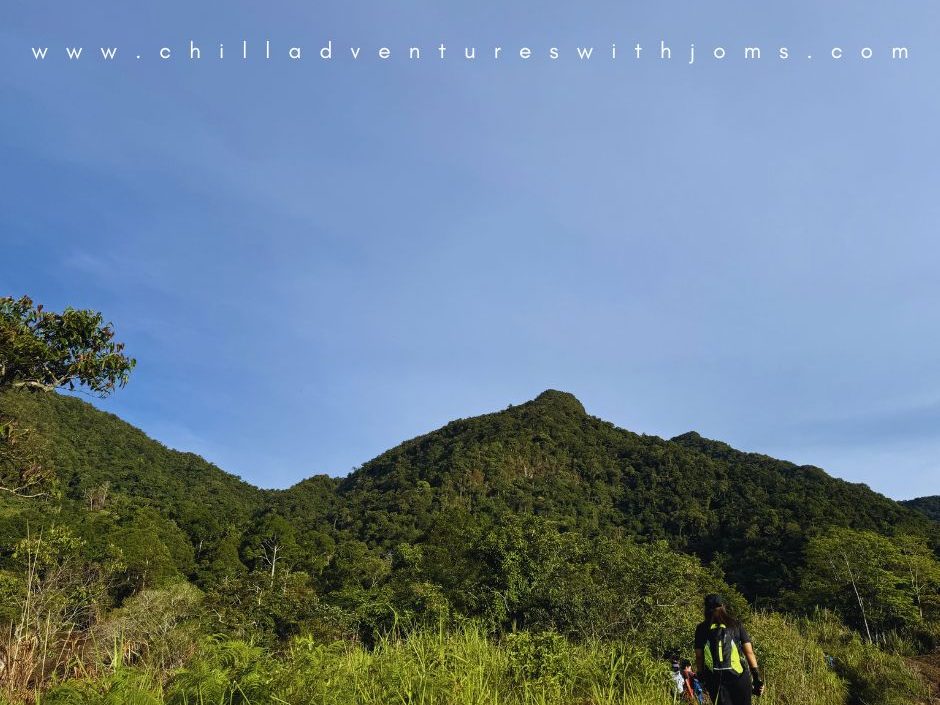
The Three T’s of Mt. Ambalawag: Trail, Toil, and Time
TRAIL & TOIL
Every mountain has its own character, and Mt. Ambalawag was no exception. From the very beginning, the trail hinted at the challenges ahead.
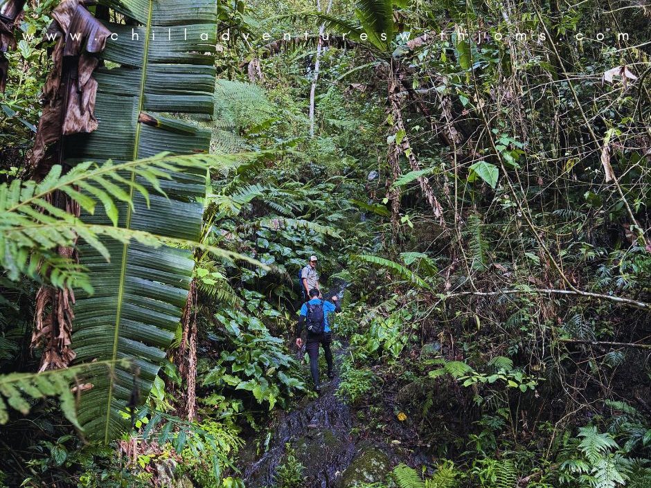
According to the local guides, it had been a while since they had visitors, and the trails were overgrown with rich vegetation, making the path even more difficult. The forest was abundant with water sources, which, while refreshing, also meant that the trails were wet, slippery, and mossy.
As we ascended, the trail grew steeper. There were no ropes, no stairs—just raw wilderness. We had to rely on tree roots, grass, and sheer determination to climb. If you’ve ever hiked Mt. Arayat, imagine gripping onto tree roots for dear life. It was like an exploration hike; our guides even had to trim vegetation just so we could pass.
At times, we had to shout to locate each other in the thick forest. Going up was challenging, but going down? That was a whole different story.

THE DESCENT: A SHOCKING TWIST
We traversed the mountain, and the descent was nothing short of an extreme adventure. The soil was loose, causing rocks to tumble down, forcing us to constantly warn those ahead. At one point, I almost lost my patience—HA!—but the thrill kept us moving forward.
Then came the biggest surprise: a 75 to 90-degree rock wall with water cascading down it. Thankfully, it was summer, so the waterfall was weak and manageable. But the fact that we had to climb down a rock wall with water flowing on it, gripping onto grass for stability—it was insane. And yet, instead of complaints, laughter echoed through the group. We embraced the unexpected.
Would you believe that 70% of the descent was essentially a waterfall hike? HAHA! No ropes, just sheer courage. If you’re looking for a heart-pounding, adrenaline-pumping adventure, this is it!

According to the local tourism, this is at 8/9 difficulty level. I tried searching other sources, but I couldn’t find any. I’d say the trail was worse than 8/9 level in my previous Mt. Dulang Dulang of Bukidnon climb. But I can’t say this is a 9/9 since I haven’t been to Mt. Guiting-Guiting. So, this rating for me really is subjective depending on the level of mountain climbing experience.
TIME: A HIKE THAT TESTED US
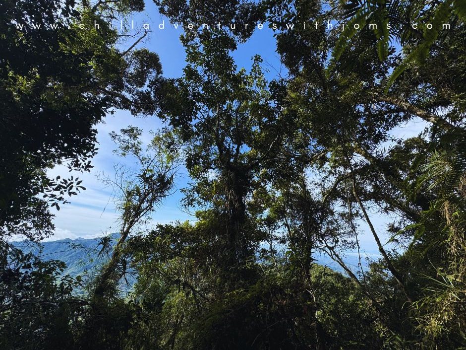
We started our hike at exactly 6:20 AM, confident it would be an easy traverse. The first part felt like a walk in the park, with crops, rice fields, and gentle trails leading to the lush forest. But once we hit the steep ascents, we knew we had underestimated this mountain.
It took us only 3.5 hours to reach the summit. After quick photo-ops and some lighthearted chitchat, we began our descent, hoping to get back early. Oh, how wrong we were!

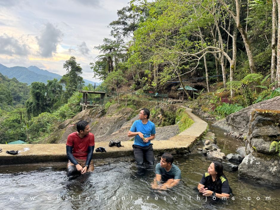
The descent took over six hours due to the slippery terrain, loose soil, and endless assaults. We finally arrived at Naumag Falls Resort past 4 PM, where we took a refreshing dip in the cold water before heading back to the jump-off site.
Water Sources? No Problem!
Worried about water? Don’t be! If your stomach isn’t sensitive, you can drink straight from the waterfalls—just use a filter to be safe. I did, and I had no issues!
ESSENTIAL PACKING LIST
- At least a liter of water since there are water sources
- Pocari or energy drink
- Salt for cramps
- Medical emergency kit
- Flashlight
- Extra Clothes
- Poncho or Umbrella (the weather is unpredictable)
- Trail Foods
- And most importantly—PATIENCE!!
Final Thoughts
And that’s it—my unexpected adventure in Mt. Ambalawag! If you’re craving a real adventure, this is the perfect hike for you. The challenge, the thrill, the surprises—everything about this climb was unforgettable.

Thinking about your next adventure? Then you’re in the right place!
Follow me on Chill Adventure with Joms and subscribe!
See you on my next blogs, mga Ka-Ahon!


2 thoughts on “A CHILL ADVENTURE? OR A CHILLING ADVENTURE TO Mount Ambalawag”