
“I may have not gone where I intended to go, but I think I ended up where I intended to be.”
-DOUGLAS ADAMS-
Social media has made Mt. Pinatubo’s 4×4 ride and scenic hike to the summit a viral sensation. From families to adventure junkies, many have witnessed how this “beautiful disaster” became one of the Philippines’ most iconic trekking destinations.
I personally experienced the 4×4 Mt. Pinatubo adventure in May 2023, and let me tell you—it was both exhilarating and breathtaking. If you’re looking for a thrilling yet manageable outdoor escape, this is a bucket-list-worthy trek you don’t want to miss.

The Legendary History of Mt. Pinatubo
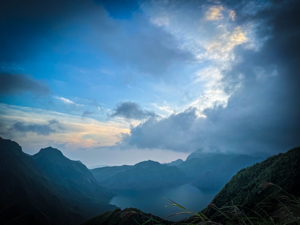
Mt. Pinatubo’s climactic eruption on June 15, 1991, was the second-largest volcanic eruption of the 20th century. Before the eruption, its elevation stood at 1,745 meters above sea level (masl), but today, its height is 1,486 masl, creating the iconic crater lake that draws thousands of hikers and travelers every year.
The Journey Begins: Pre-Departure Hiccups
Like any great adventure, ours started with some unexpected challenges. Heavy rains poured the night before our departure, and I was the last to arrive at our designated pick-up spot at Greenfields Parking. This meant I had to carry my massive backpack on my lap for the four-hour van ride—a struggle I won’t soon forget!
The Ultimate Pinatubo Adventure: Time, Toil, and Trail
Now, let me take you through the three T’s of this hike—Time, Toil, and Trail—to prove that this is indeed a must-try adventure for thrill-seekers and casual trekkers alike.
🕒 TIME: The Journey to the Jump-Off Point
We arrived at Castillejos, Zambales around 4 AM, prepped our gear, and hopped onto a tricycle ride (locally called “Kulong-Kulong”) that took us to the starting point. The one-hour ride was bumpy and dusty, with lahar-covered trails that set the tone for the adventure ahead.

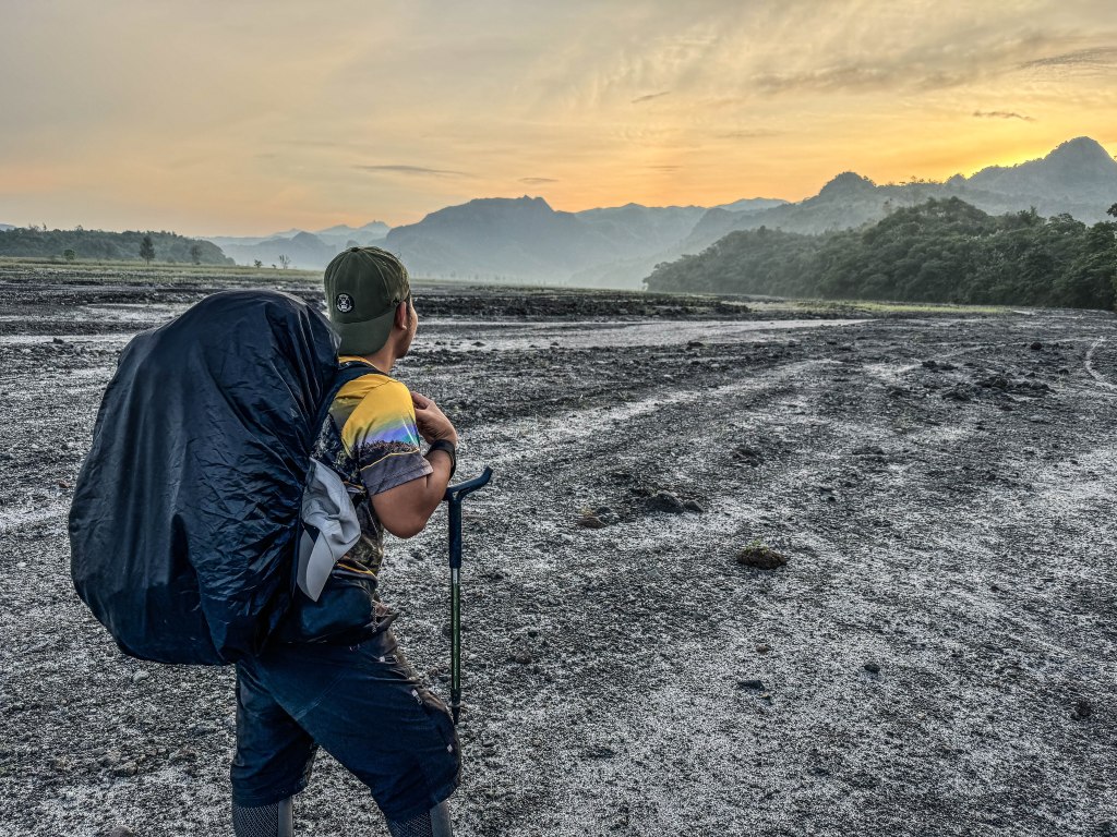
At 6 AM, our trek officially began. The first part was relatively easy, crossing a shallow river and walking on sandy, rocky terrain. But as the sun rose higher, the heat became more intense, making the hike more challenging. With no shade except for tall talahib grass, we relied on cold river dips to stay cool.

My backpack was heavy, more than ten kilos maybe. I had 1.5 liters of Pocari drink, 3 liters of water, biscuits, a box of lechon manok for my lunch, and 6 pieces of biscuits. I brought my own tent, sleeping mat, umbrella, poncho, a powerbank, 4 clothes, 3 shorts, 3 undies, my drone and cameras, my phone, my toiletries, and my blanket.
To lift our spirits while waiting for the rest of the group, our local tour guide shared a chilling yet captivating story about how entire barangays and schools were swallowed by lahar after Mt. Pinatubo’s catastrophic 1991 eruption. The disaster not only buried homes and livelihoods but also claimed countless lives, forever changing the landscape of the region.
With the sun already blazing high in the sky, we embarked on our trek, immediately facing our first challenge—a river crossing. Fortunately, the water was just gutter-deep, making it a refreshing start rather than a daunting obstacle.
However, as the hours passed, the intense heat began to take its toll. The trail, composed of scorching lahar rocks and loose sand, reflected the sun’s heat like an oven, draining our energy with every step. Unlike dense forest trails, this route offered no shade—only towering talahib grass swayed in the wind, providing little relief from the relentless sun.

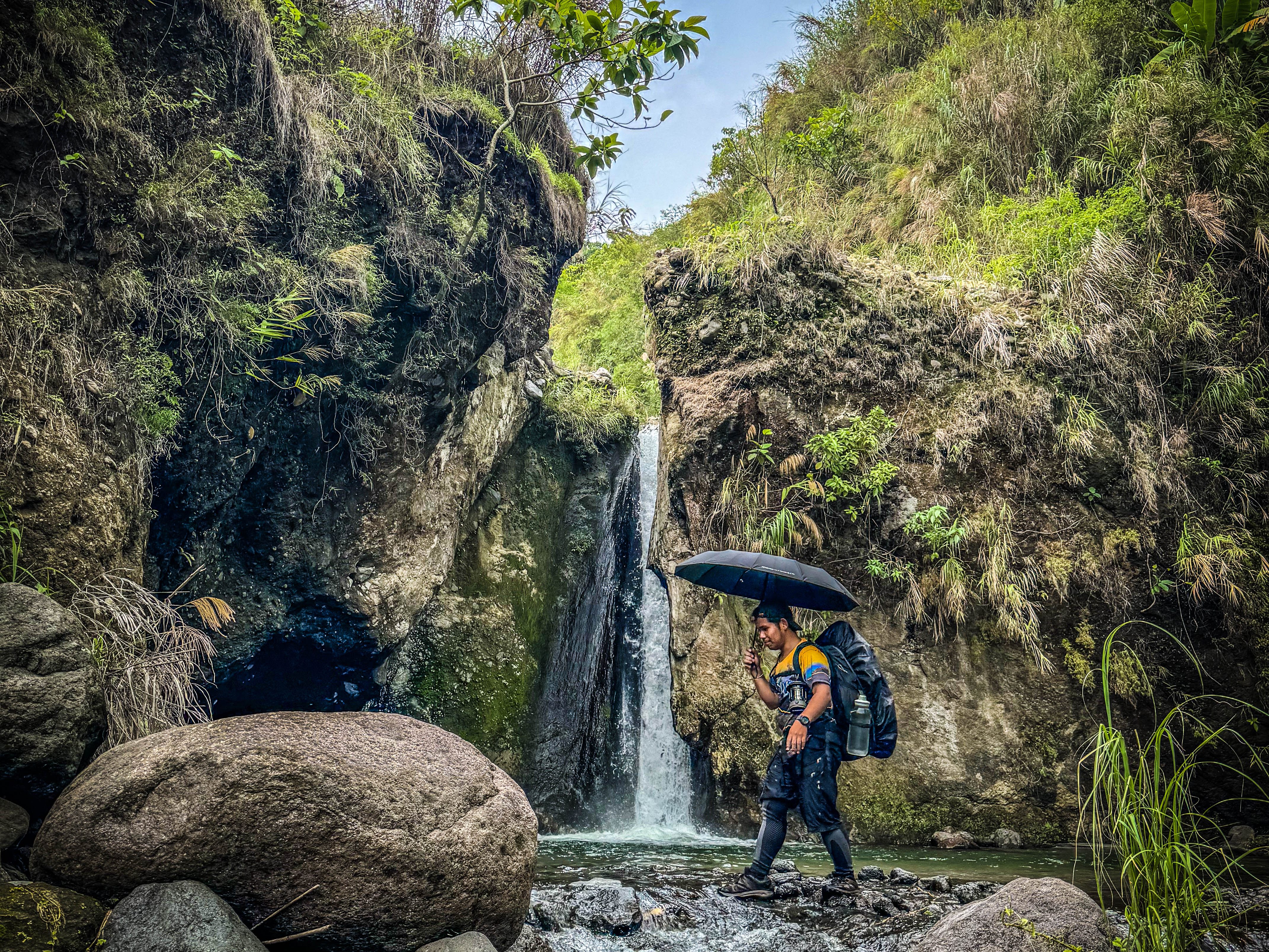
We reached a hidden waterfall at noon, a refreshing stop where we swam and refilled our bottles with fresh water. After an hour, we resumed our trek, crossing multiple rivers and tackling steep ascents and descents before finally arriving at the campsite at 4 PM.
I was the first to arrive at the Mt. Pinatubo campsite, eager to find the perfect spot to pitch my tent. With exhaustion settling in after a long and grueling trek, I carefully chose a safe and level ground, ensuring a comfortable night’s rest before the big summit push.
As night fell, the cool mountain breeze wrapped around us, and the aroma of hot tinola filled the air—an absolute treat after an intense day of hiking. Our local organizers prepared our well-deserved feast, and as we gathered for a quick social, laughter and stories flowed, making the adventure even more memorable.
Before long, our guide reminded us to get some rest—we had a challenging midnight ascent to Mt. Pinatubo’s summit ahead. At exactly 12:30 AM, we woke up then had our qucik breakfast, laced our boots, and braced ourselves for the most thrilling part of the journey.
💪 TOIL: The Challenges of the Hike
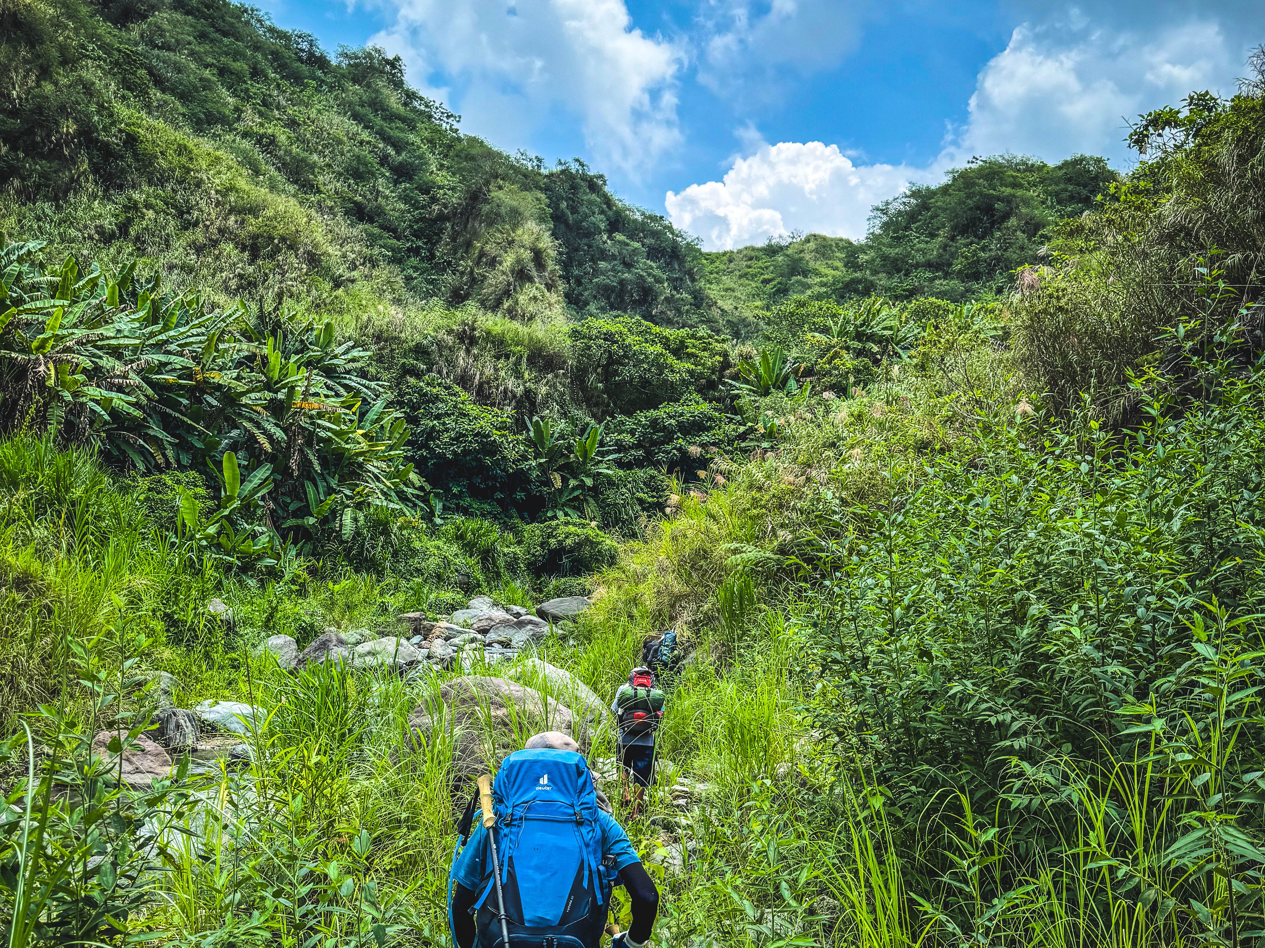
This trail had only recently reopened, and we were among the first few groups to experience it. The entire trek covered almost 40 KM, involving endless river crossings, boulder climbs, knife-edged ridges, and open trails under the scorching sun.


Here’s the hours we hiked
DAY 1
- 6AM – 4PM Roughly 10 hours from jump off point to the camp site
DAY 2
- 1:30 AM – 5:30 AM Approximately 4 hours to the summit
- 6:30 AM – 9:30 AM Depending on your pacing 3 hours going back to campsite
- 11:30 AM – 5:30 PM Roughly more than 6 hours hike back to the jump off point
Unfortunately, we waited for two hours for our Kulong-kulong ride. It was pretty inconvenient, but I think it’s just part of an amazing adventure I will never forget.

Compared to Cawag Hexa and Mt. Ambalawag, this trail was slightly easier due to the availability of multiple water sources. However, the constant sun exposure, loose soil, and steep slopes made it physically demanding.
🏞 TRAIL: What to Expect
🚰 Unlimited River Crossings – Prepare to get wet! Most of the trail consists of knee-deep (sometimes waist-deep) rivers. Wear quick-dry gear and waterproof your belongings.
⚠️ Slippery Ascents and Descents – The loose soil and mossy rocks require good traction shoes. Ropes are available in certain sections for extra support.
🌞 Open Trails – About 95% of the hike is exposed to the sun. Wear long sleeves, a hat, and sunscreen to protect your skin.

THINGS TO BRING:
- Drifit shirt, shorts good for two days
- Water but there are fresh water sources if you don’t have a sensitive stomach
- Energy drink
- Trail food (nuts, candies, chocolates, etc.)
- Tent or share with your friends
- Sleeping Mat
- Off Lotion
- Sunscreen/sunblock lotion
- Arm Sleeves
- Emergency Medical Kit
- Toiletries
- Leggings
- Cap, umbrella or poncho
- Powerbanks
- Flashlight and extra batteries

Final Thoughts: A Chill Adventure or a Chilling One?
The Mt. Pinatubo hike via Lubot Trail is a perfect blend of adventure and relaxation. It challenges you with river crossings, steep ascents, and exposed trails, but rewards you with breathtaking landscapes, refreshing waterfalls, and an unforgettable summit view.
So, what do you think? Is this a chill adventure or a chilling one? Let me know in the comments if you’ve hiked this trail or if it’s on your bucket list!
Don’t forget: Leave No Trace! Let’s keep Mt. Pinatubo beautiful for future adventurers. 🌍✨
See you in the next adventure, mga ka-Ahon! 🚀


Where exactly is the jump off point with the tricycles??
LikeLike
That’s home of one of our local guides. Thats in Magsaysay Castillejos Zambales/
LikeLike