
“Sometimes the most unexpected trails lead to the most breathtaking views—like a hidden treasure waiting to be discovered when you least expect it.”
I’ve always believed that the best adventures come when you least expect them. This midyear adventure was one I never imagined would be so enjoyable, especially towards the end of 2024!
As usual, I was invited by King Arthur, my favorite (though I might be a little biased) organizer in the mountain hiking community. I couldn’t pass up this opportunity, so I joined him on this new adventure.
This trail, recently opened by another well-known organizer, Mudman, led us to Mount Sicapoo. While there’s another famous trail— the Solsona Trail / Sicapoo Traverse — many hikers say it’s one of the toughest. But this new route was far easier and offered a more relaxed, scenic experience.
Mount Sicapoo stands tall as the highest point in Ilocos Norte at 2,361 meters above sea level (7,746 feet), located in the Cordillera Central of Ilocos Norte and Abra.
Now, let me take you through the Three T’s of my hike: Time, Trail, and Toil. I usually break it down this way in my blogs, based on my own experiences. So, let’s dive in! (Warning: my assessments may be a bit subjective! 😄)
TIME
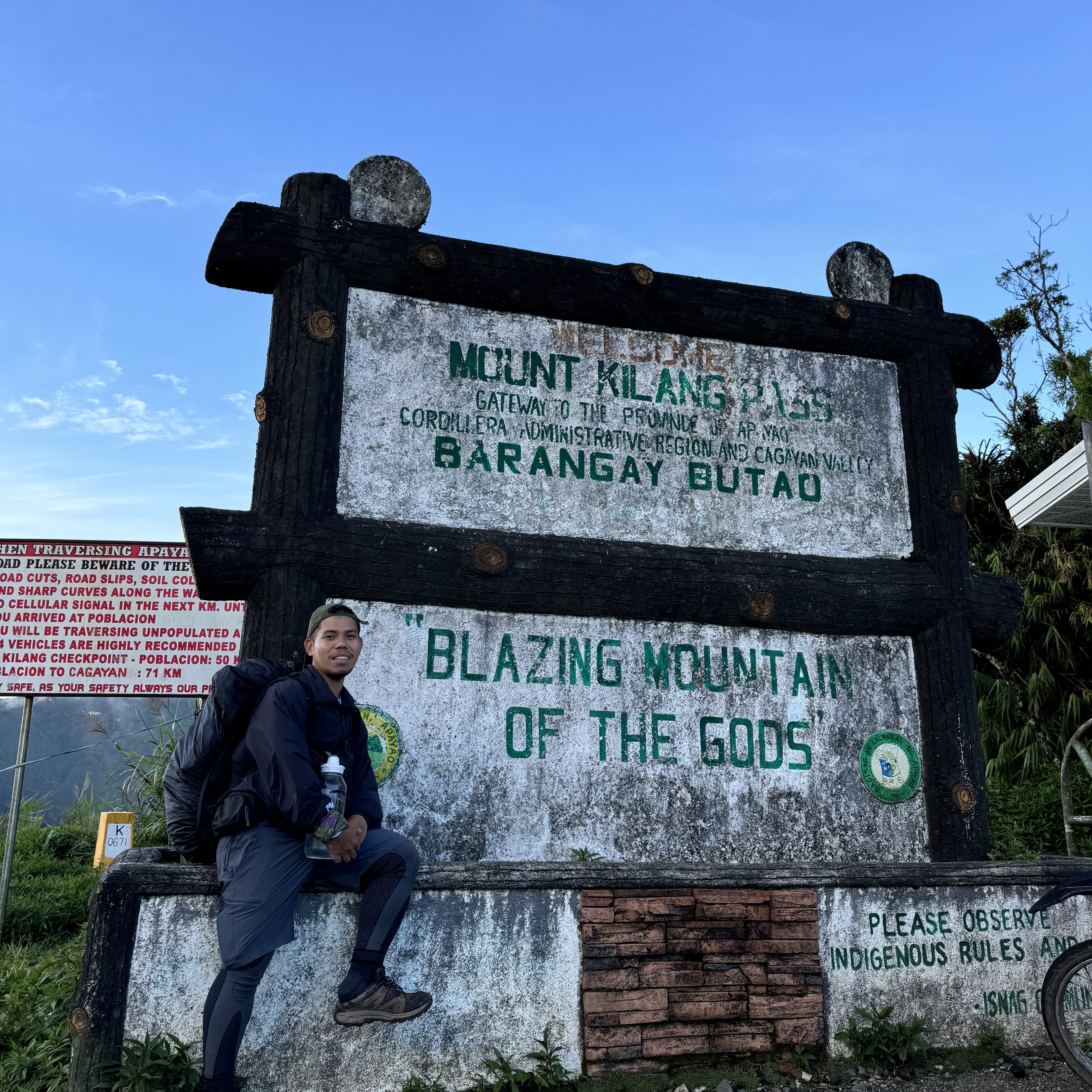
Our original plan was to leave by 3 PM, but because this was a semi-DIY setup, we ended up leaving closer to 5 PM. It was a long journey, taking more than 12 hours to reach the jump-off point at Kilang Pass, Canlasan, Apayao. This was my first time stepping foot in this remote province!
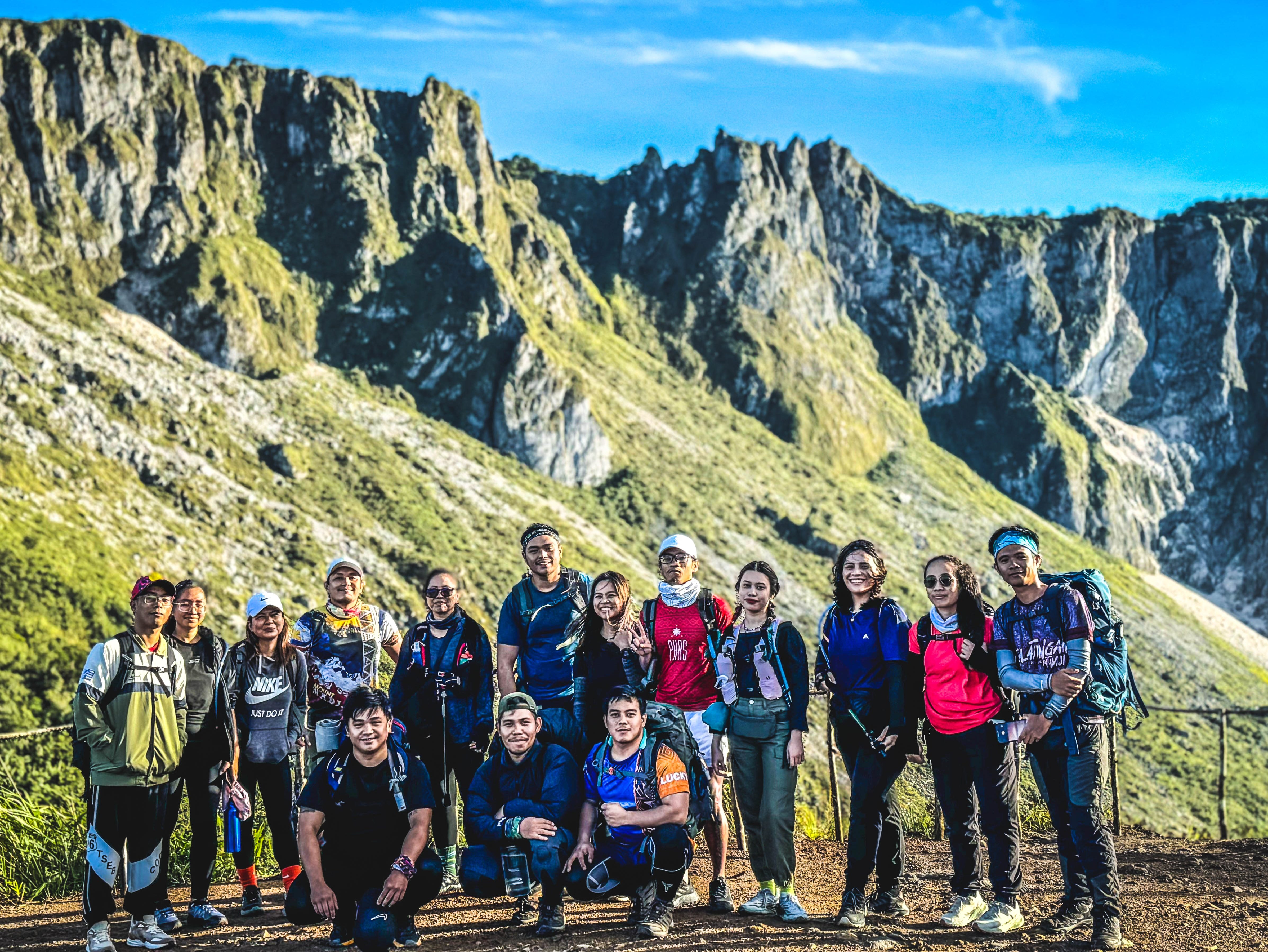
Finally, the moment had come! We had a quick breakfast at a local store (eggs, pancit canton, and rice), snapped a group photo, and began our hike.
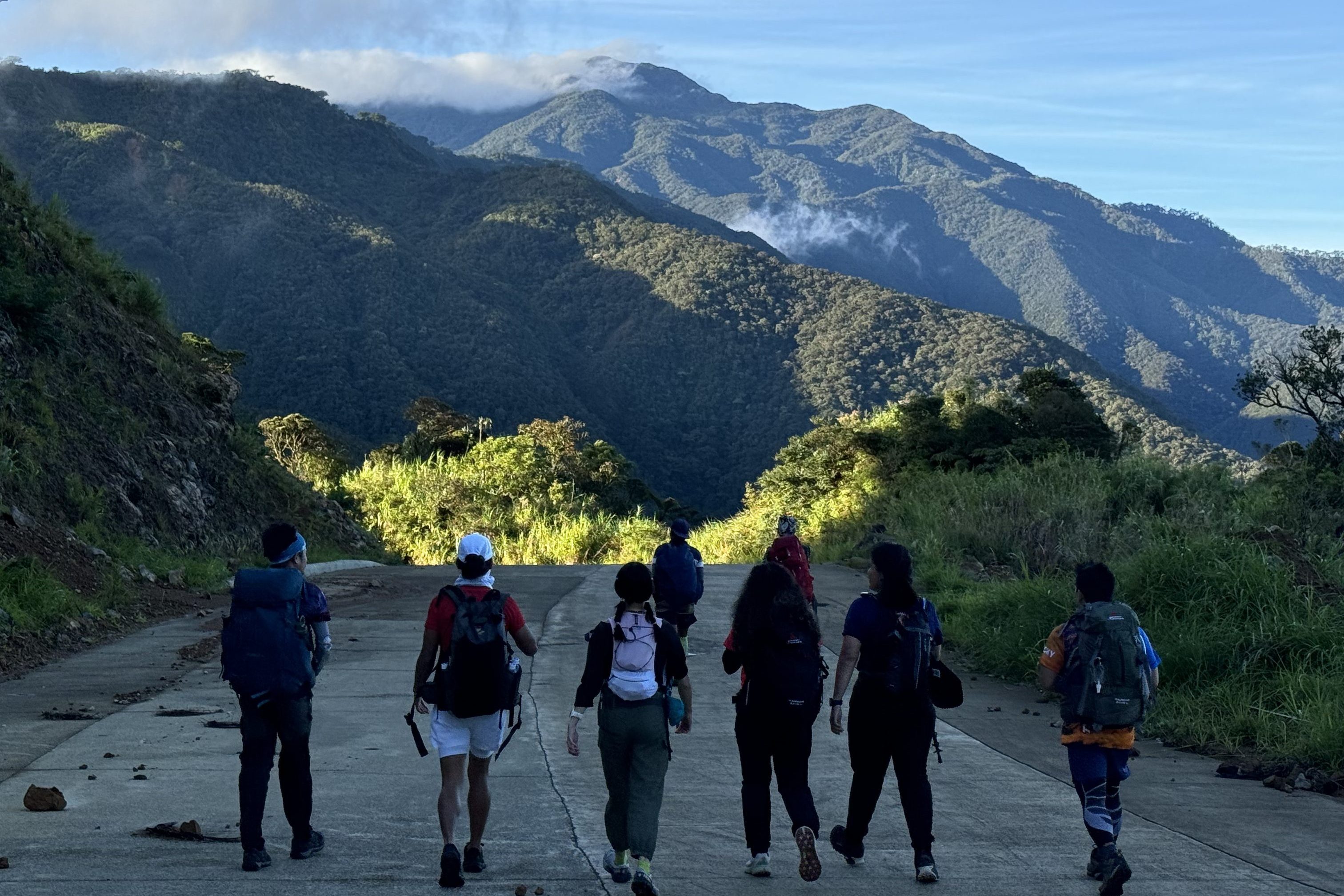
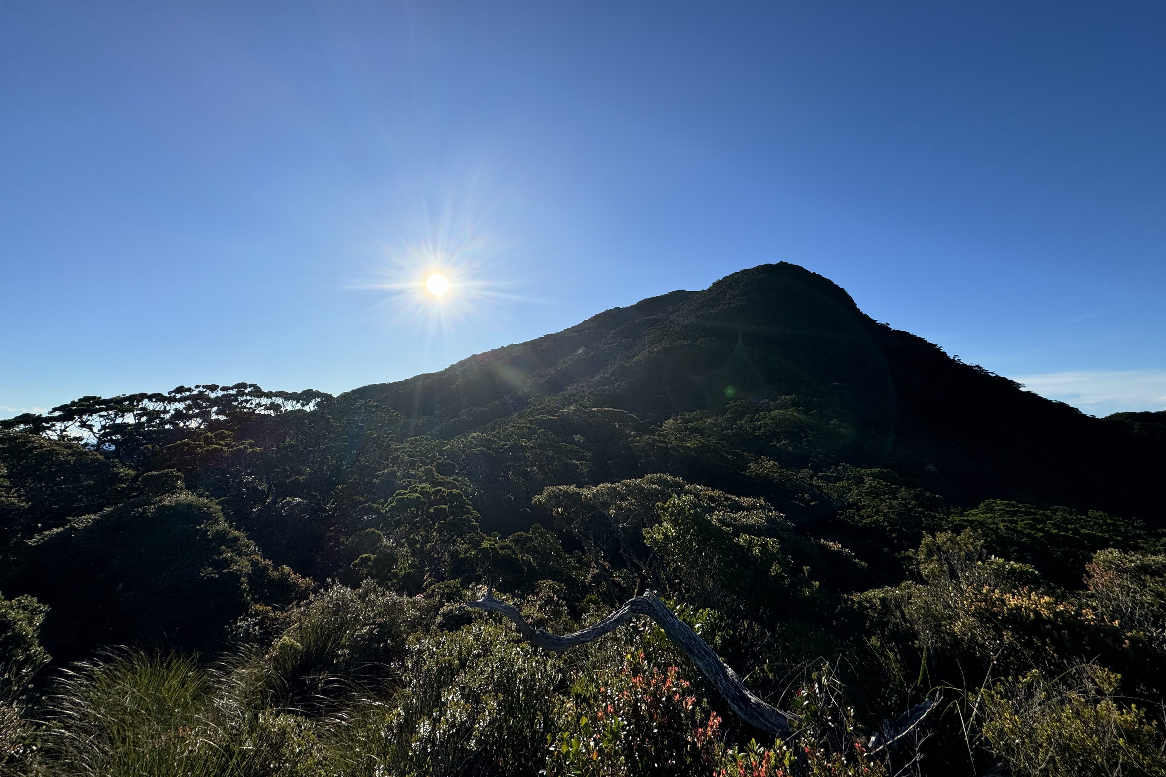
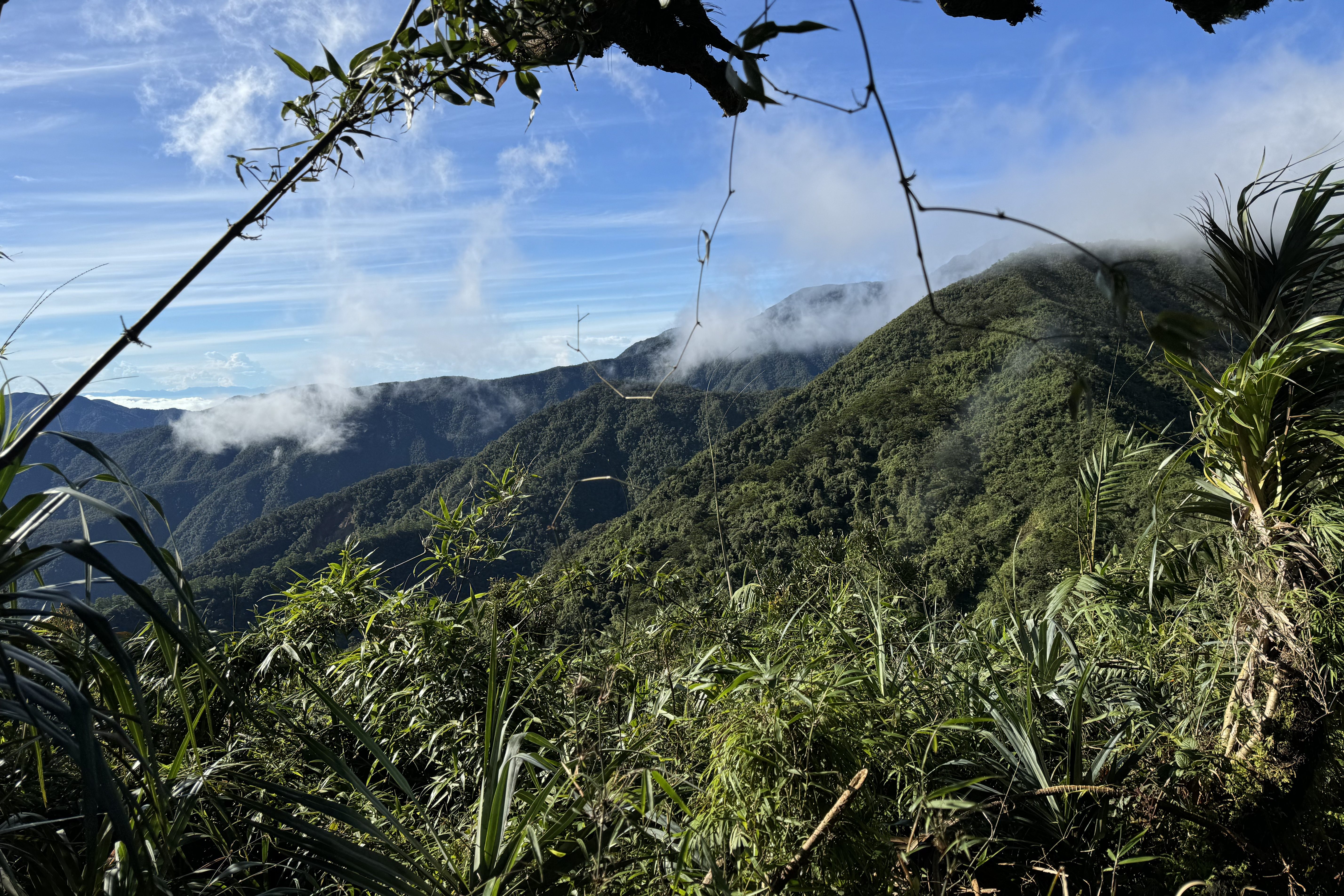
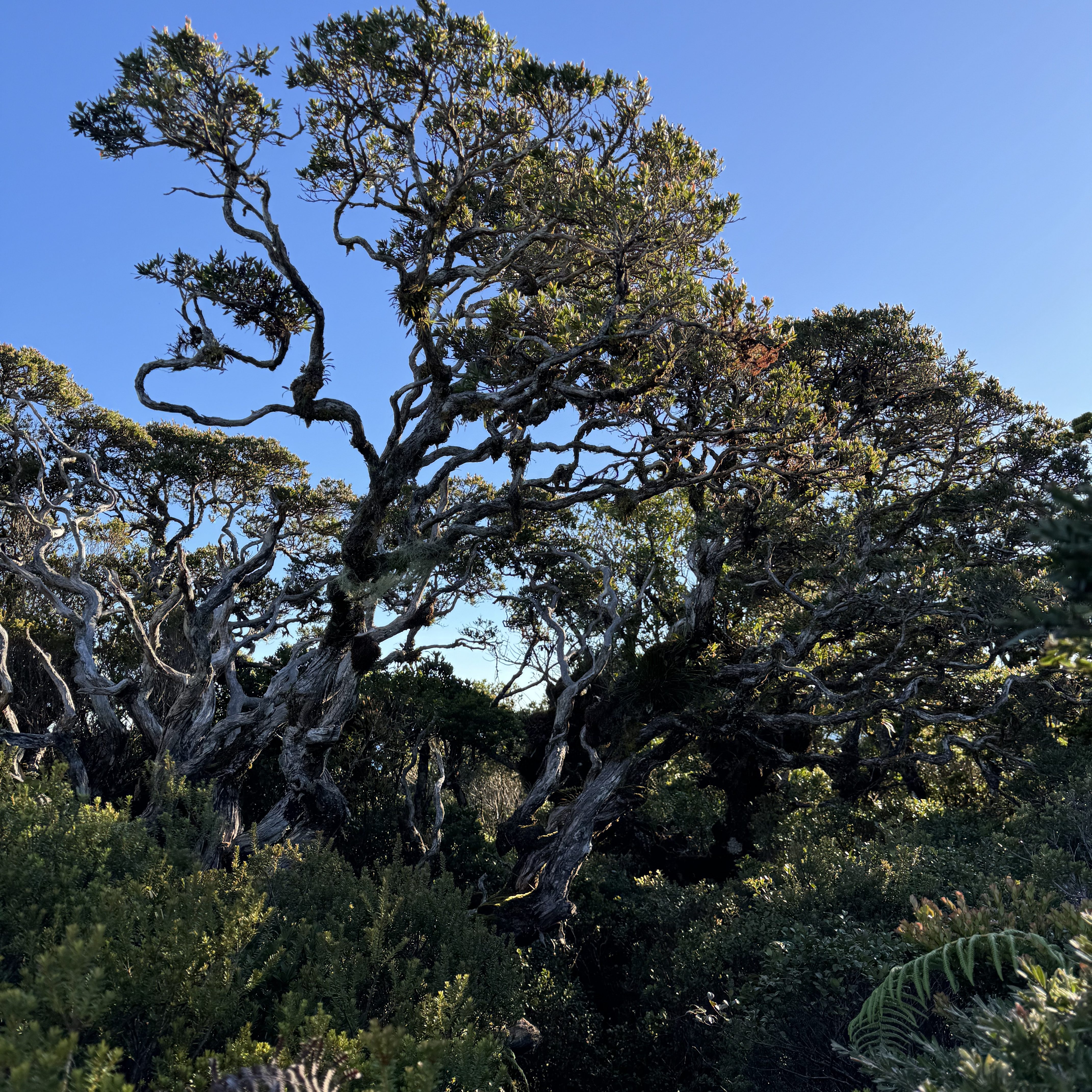
The journey started on a road, with a strong breeze making it seem like we were in for perfect weather. From a distance, we could see a sea of clouds. After less than an hour, we reached a stunning spot with Mount Kilang as our backdrop. This was where the official trail— a beautiful mix of grassland and forest— began.
The trail was a series of rolling hills. Up and down, up and down. You really had to catch your breath, then descend, only to climb again. There were several ridges where, if you weren’t careful, a slip could mean falling into trees below. (But no worries, the trees would probably catch you, or at least break your fall! 😜)
It took us over 4 hours to reach Camp 1, where we had lunch. Another 4 hours led us to Camp 2, where we’d spend the night before heading to the summit.

As darkness fell, the temperature dropped. The wind howled, making the trees sway and whistle in the eerie silence. We enjoyed a hearty dinner and were told to wake up at 3 AM for a quick breakfast before preparing for the summit climb.
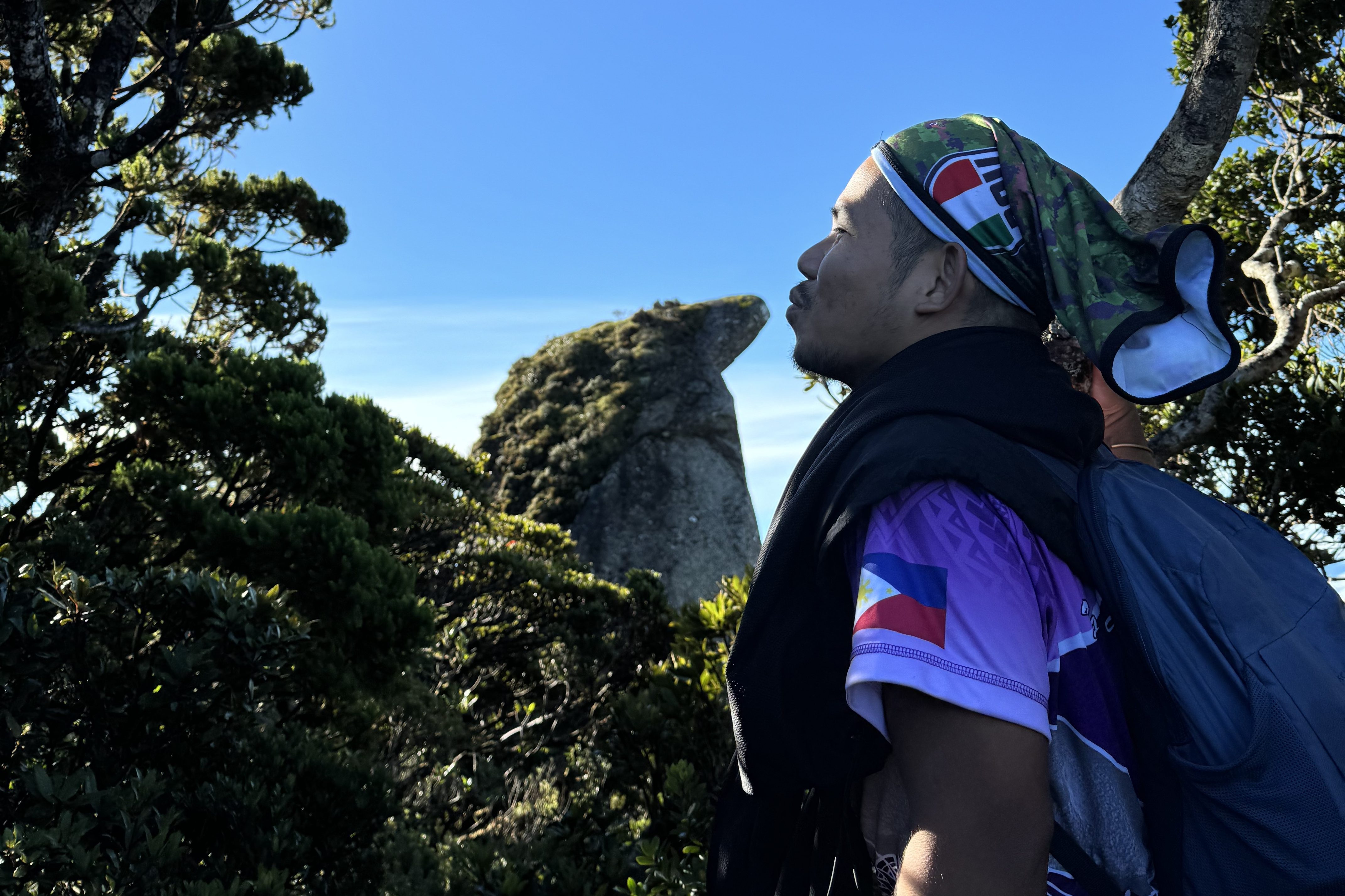
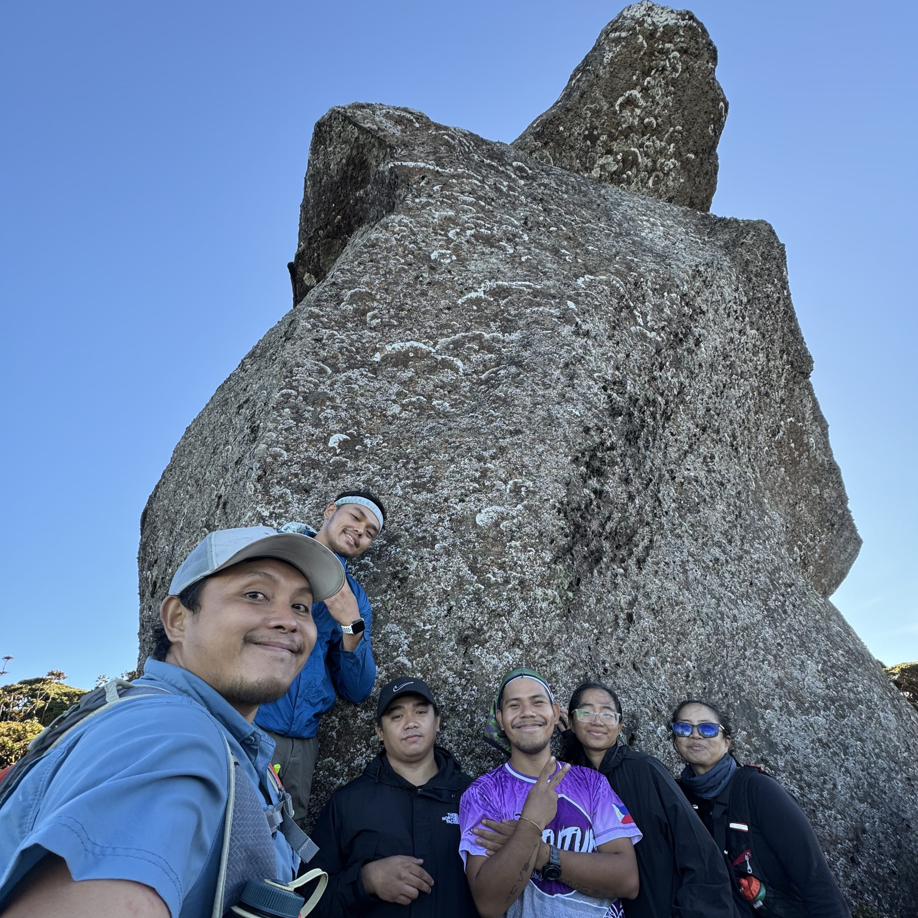
We finally reached the summit after 3 hours of hiking. It wasn’t easy, but the views were worth it. Our guide informed us that if we didn’t make it by 9 AM, we would miss the clearing and the breathtaking views of the Ilocos Region and the Cordillera Mountain Range. Luckily, the weather held up, and we caught a glimpse of the famous Penguin Rock at the summit just in time.

We spent about an hour at the top, snapping photos and taking in the beauty. Then, as clouds began to roll in, we started our descent.
We broke camp with smiles on our faces. This was one of the most beautiful trails I’ve summited in my mountain climbing journey. By 7 PM on Day 2, we were back at the jump-off point, and we immediately set off to return to Manila.
TRAIL
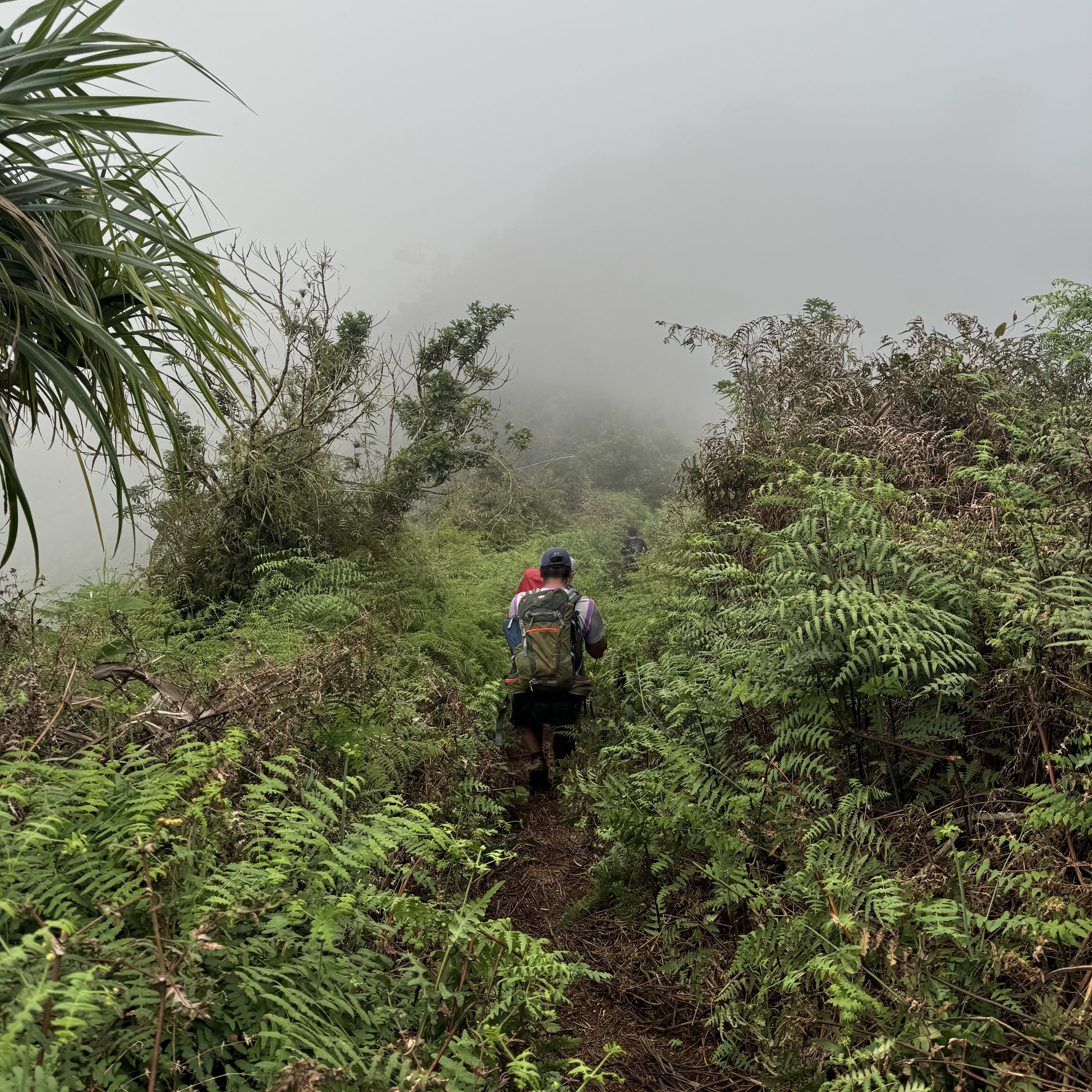
This trail is much easier than the Sicapoo Traverse via Timarid-Simagaysay. The path had some rolling hills that tested our endurance, but overall, the trail was relatively manageable, especially given the stunning views that made the effort feel worthwhile.
Had it rained, though, the trail would’ve been much more challenging. We were fortunate to have fair weather. The ridges seemed endless, but the thick forest provided a nice cover so we couldn’t see how far we could fall (which was a relief 😄).
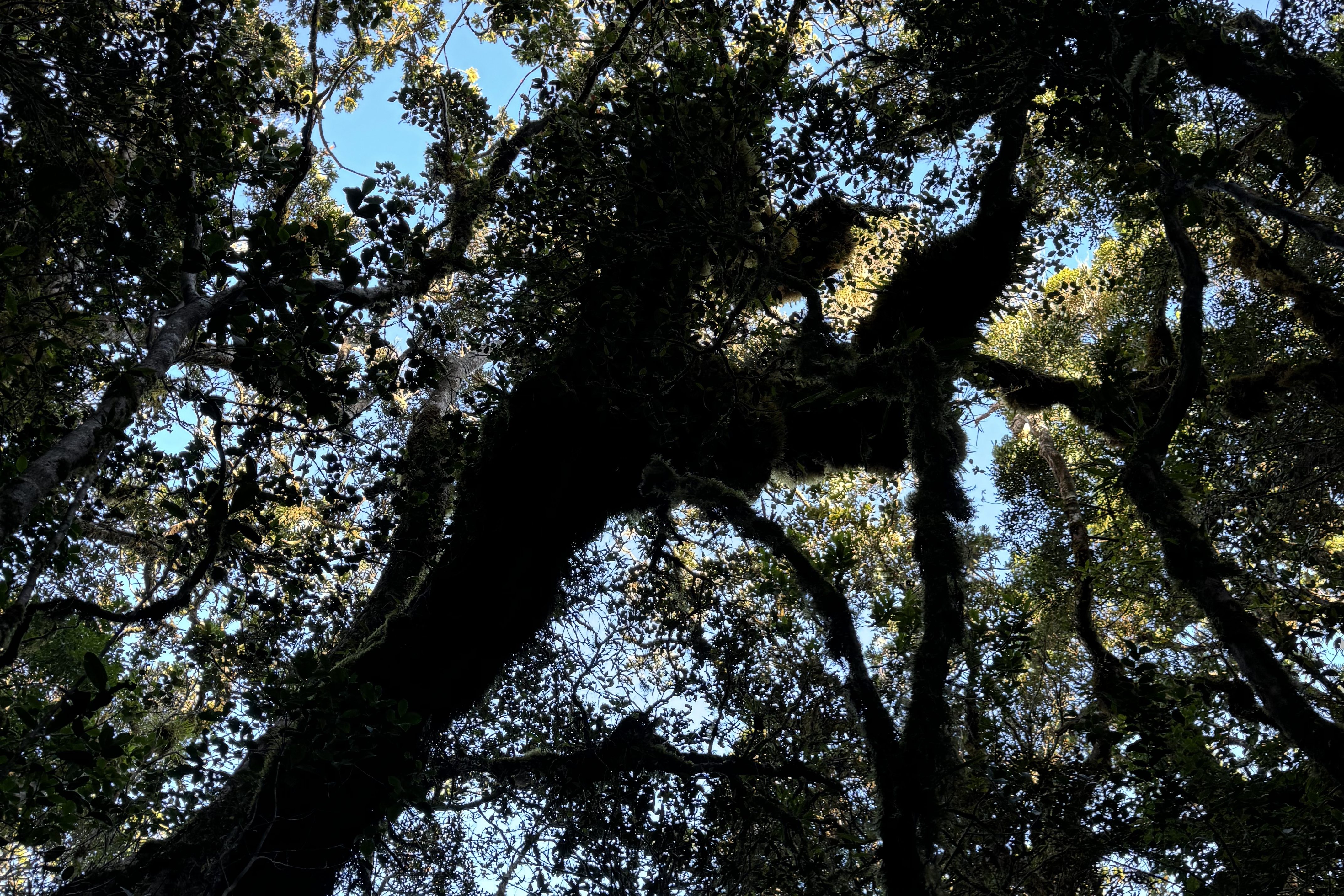
The mossy forest was absolutely beautiful. The moss covering the trees and trails is evidence that this area has remained largely untouched and preserved for many years. Despite being in a tropical region, the forest’s climate was cool and refreshing.
Be sure to hire a local guide if you plan on taking this trail. Locals have their own paths, and it’s easy to get lost. Though hunting (pangangaso) is prohibited, some locals still engage in it due to poverty. If caught, they face penalties, as explained by the locals.
TOIL
Before I hiked this trail, I couldn’t find a reliable source that detailed its exact difficulty level, as it had just been opened. Based on my own experience, however, I’d say this trail is easier than Mount Dulang-Dulang and definitely less challenging than Mount Apo.
One thing to be aware of: limatik (leeches), especially during the rainy season. Be prepared! There are plenty of them on this trail.
While there are day-hike options, I recommend making this a two-day hike. Doing so will allow you to fully immerse yourself in the beauty of the trail and enjoy the refreshing breeze in the forest.
This is definitely one of the mountains I plan to revisit in the future.
Final Thoughts
If you’re planning to hike Mount Sicapoo via the Apayao Trail, don’t forget to check out my blogs for a detailed experience of the hike. This is a must-visit mountain!
Remember, it’s a two-day hike, so PLAN AHEAD AND PREPARE! And, of course, always follow the Leave No Trace (LNT) principles.
I hope this blog was helpful. Just One More Step toward more #ChillAdventures!

Follow and subscribe to all my social media channels at Chill Adventures with Joms.

