
“I go to nature to be soothed and healed, and to have my senses put in order.”
-John Burroughs-
This adventure sat quietly in my drafts for more than a year—an unforgettable climb I once thought I would never finish.
Alone on the trail, time felt frozen. Yet in that solitude, I found a calm I still carry with me today. Mt. Namandiraan became my northernmost major hike and my farthest trek in North Luzon last 2024 —a milestone that tested both my body and spirit.
At the time, I was juggling two jobs, squeezing this epic climb in between responsibilities, guided by close hiking friends who felt more like family. I was picked up in Pampanga after a quick work stop, and along the way, I finally met a storytelling legend—The Living Genes—for the first time.
A grueling 12-hour road trip through winding mountain roads tested our endurance even before the hike began. We arrived at the trailhead past 3:00 AM—no sleep, no warm-up, just pure, raw adventure.
Now, let me take you through the heart of this unforgettable climb: Time, Trail, and Toil.
TIME & TRAIL
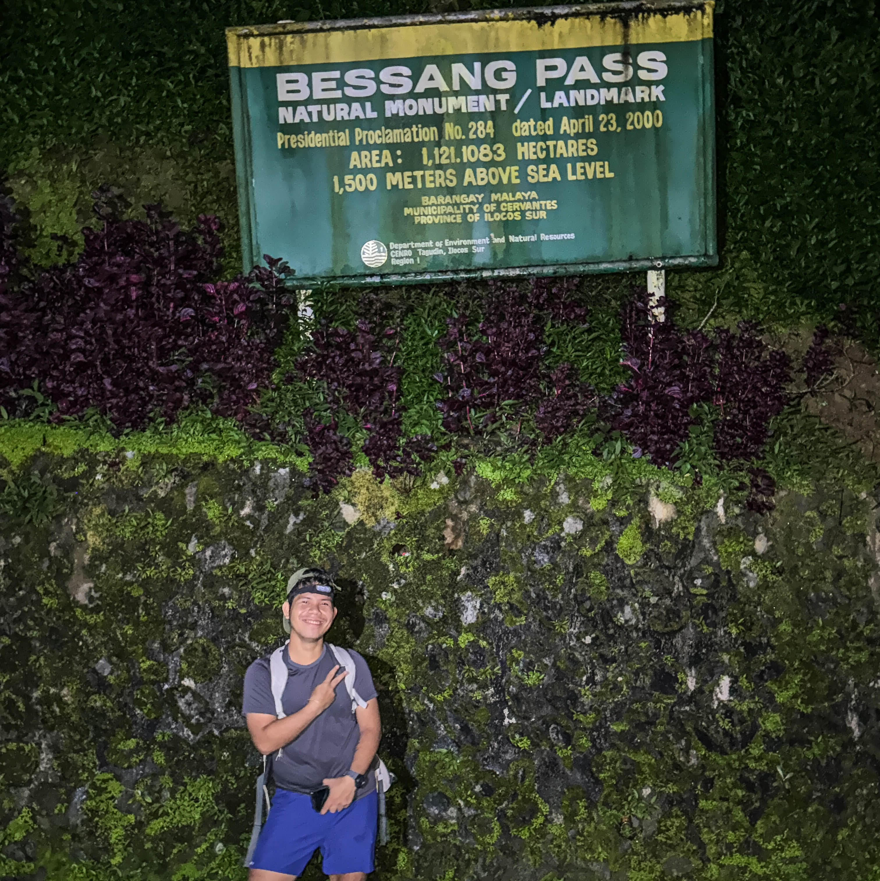
We arrived at the cold jump-off point at Besang Pass National Monument in Cervantes, Ilocos Sur, already behind schedule from the supposed 2:00 AM start. The road was slick from rain the day before, and the cold mountain air cut straight through us.
The first section of the hike was deceptively easy—a long cemented road—but the wet surface and freezing breeze made it more challenging than expected. Had I known how cold it would be, I would’ve brought a jacket.
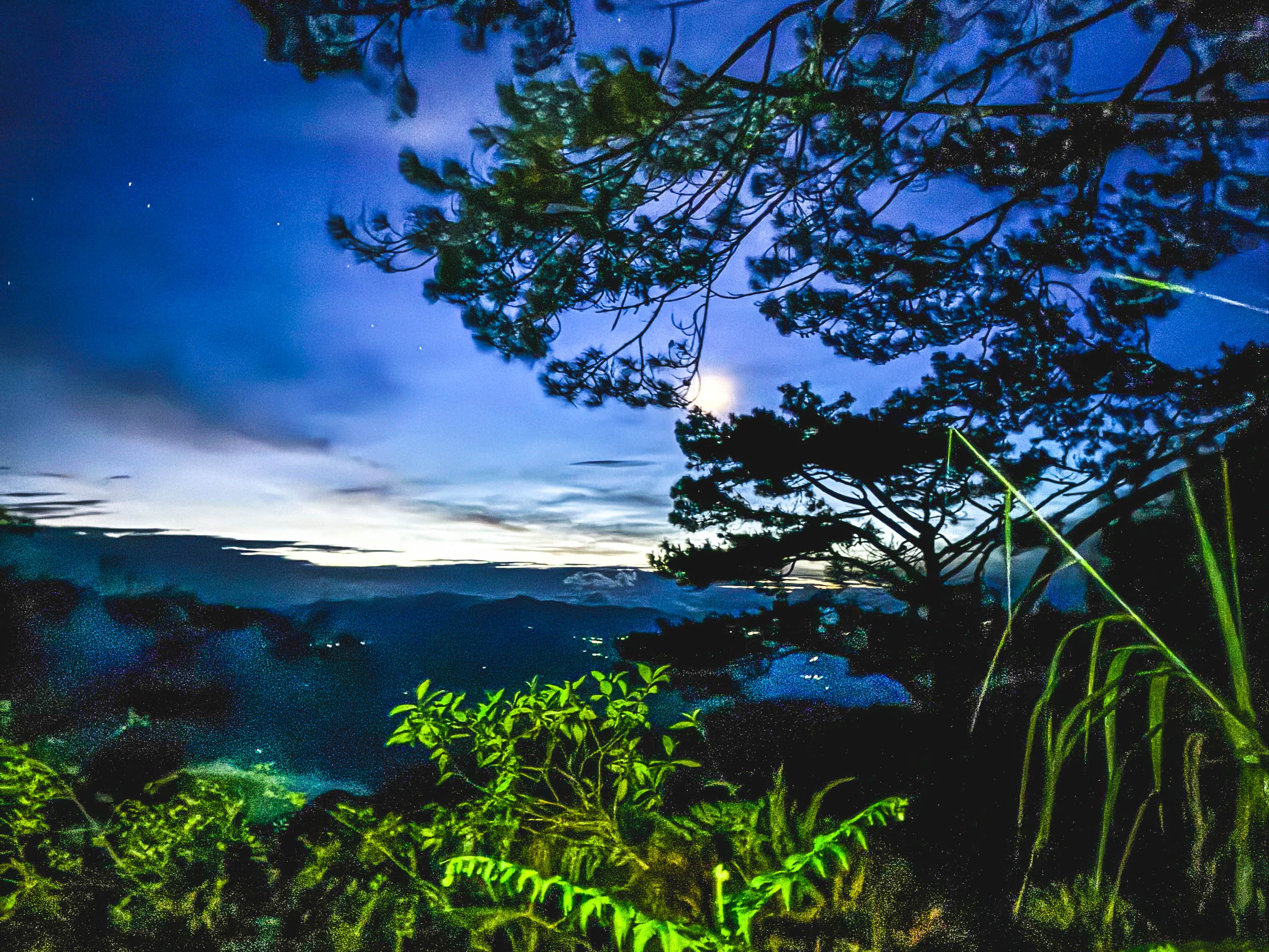
Running on zero sleep made everything heavier. The lead group moved fast, almost like planes taking off. We passed quiet vegetable farming communities, then endless pine trees and rolling grasslands. Though it was still dark and biting cold, we pushed on, racing the sunrise.
The trail was a constant rhythm of short descents followed by relentless ascents. By 5:00 AM, dawn slowly cracked open the sky—soft light spilling over the mountains, a promise of a clear and beautiful day.

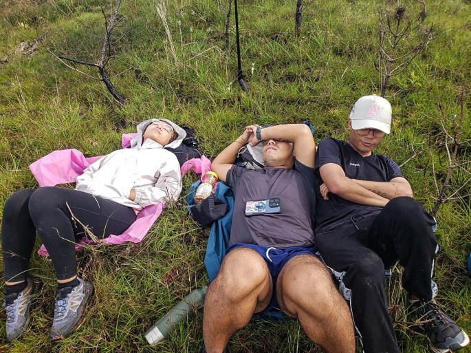
We stopped briefly under a pine tree for a quick breakfast, sharing stories from past climbs. Minutes later, we entered the mossy forest, where the air grew colder and the trail more technical. The ascents became tougher but still manageable. As the sun rose higher, visibility improved—and so did our spirits.
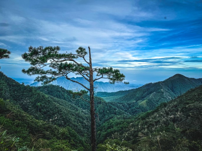
The talahib grass grew thicker, untouched for months. Still, as we gained elevation, the views opened up. The mountains of Ilocos revealed themselves—vast, green, and quietly majestic.
After nearly three hours of nonstop ascents and descents, our guide told us we were about two hours from the summit. He warned us about limatik-infested sections, which had already started biting some of my co-hikers.
We pushed on. Breathing became harder as the continuous climb through the mossy forest drained what little energy I had left. I found myself among the lead group; two had already gone ahead toward the summit.
I slowed down—not out of weakness, but to take everything in. Fallen trees were slowly being reclaimed by moss. Tall trees stood untouched, ancient and silent. I stopped thinking about the bloodsuckers and simply walked.
Soon, the talahib grass returned. The guide said we were close.
The mossy forest faded into tall pine trees swaying gently in the cold wind. At around 7:00 AM, after nearly four hours of climbing, we reached a clearing under a bright blue sky.
Summit.

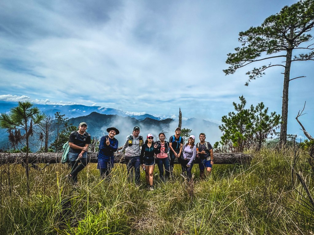
We took photos, shared smiles, and soaked in the moment. Wrapped in cold mountain air, I slept for almost an hour at the summit—completely at peace.
By 9:30 AM, we began our descent.
THE LONG WAY DOWN
I thought the rolling trail was over. I was wrong.
The descent was steep—one misstep felt unforgiving. As we dropped lower, the cold breeze slowly disappeared. My body was drenched in sweat, exhaustion creeping in.

We passed through steep pine forests, the trail loose with sand and small rocks—slippery and dangerous. Tired, I moved ahead alone, keeping the guide and a friend in sight. Whenever they got too far, I shouted just to make sure we were still connected.

After a long downhill, we reached rope sections and grassy trails. At one point, I nearly got lost, but the freshly cut grass from hikers ahead guided me back.
The sun grew harsher, almost unbearable. Two hours passed, yet the jump-off point felt endlessly far.
Then came the surprise—another ascent.
Steep ridges tested my biggest weakness: exposure. Looking down at sharp rocks made me nauseous. One wrong move felt fatal. Still, we pushed on, stopping only briefly.
By around 2:00 PM, we reached the final tricky descent near the mahogany trees—our last water source. Exhausted, I slept for nearly an hour while waiting for the others.
Past 2:00 PM, we decided to move ahead with the guide’s approval. Just then, rain poured down with thunder—a welcome relief from the burning sun.

We rushed through farming communities rich with rice fields and vegetables, dogs barking as we passed. By 3:00 PM, we crossed the long steel hanging bridge—another personal fear conquered, one careful step at a time.
We were close. Or so we thought.
Our guide was far behind, and we mistakenly took the wrong trail. Realizing we were lost, we backtracked, shouting until the guide spotted us from afar. He redirected us—across rice paddies and up a steep climb toward the barangay covered court.

Breathless but determined, we pushed on.
We finally reached the jump-off point past 4:00 PM, about 20 minutes after the lead group.
Exhausted. Fulfilled. Alive.

TOIL: HOW HARD IS MT. NAMANDIRAAN?
So, how difficult is Mt. Namandiraan? Is it beginner-friendly for major hikes?
Yes—with proper preparation.
With the right physical and mental conditioning, this mountain can be an excellent training ground. Online sources rate it at 8/9 difficulty, and I agree. Expect steep ascents and descents, rocky and sandy trails, limatik-infested sections, and slippery terrain.

Mountain difficulty is always subjective. It depends on how you prepare, how active you are, and even what you fuel your body with.
FINAL THOUGHTS
I don’t hike just because I love it.
I hike to test my limits.
Mt. Namandiraan pushed me hard—long rolling trails, steep climbs, ridges, and endless descents tested my endurance. I may not have reached my absolute limit yet, but this climb reminded me to prepare every single day.

No mountain is ever small. They existed long before us.
Hike not to conquer mountains—but to conquer yourself. They are there to show their beauty, and in return, reveal the strength and beauty within you.
Testing your limits is how you discover the quiet power you never knew you had.
❓ Frequently Asked Questions (FAQs)
1. Where is Mt. Namandiraan located?
Mt. Namandiraan is located in Cervantes, Ilocos Sur, North Luzon, with the usual jump-off point near Besang Pass National Monument. It is part of the Cordillera mountain range and offers expansive views of the surrounding Ilocos mountains.
2. How difficult is Mt. Namandiraan and is it beginner-friendly?
Mt. Namandiraan is considered a major hike with a difficulty rating of 8/9. While it is physically demanding, beginners preparing for major climbs can attempt it with proper training, mental readiness, and guidance. The trail tests endurance through steep ascents, rolling terrain, and technical sections.
3. How long is the Mt. Namandiraan hike?
A full Mt. Namandiraan day hike typically takes 10–14 hours, depending on pacing, weather conditions, and group size. Expect long ascents, short descents, and extended exposure to the elements.
4. What are the main trail challenges on Mt. Namandiraan?
The hike includes steep ascents and descents, rocky and sandy trails, slippery pine forest sections, talahib grass, and limatik-infested mossy forests. Weather changes and exposure on ridges also add to the challenge.
5. What is the best preparation for hiking Mt. Namandiraan?
Proper preparation includes cardio and leg strength training, mental conditioning, adequate sleep before the climb, and proper nutrition and hydration. Wearing trail-appropriate footwear and bringing protection against cold, rain, and limatik is highly recommended.

I hope this adventure inspires and prepares you for your own #ChillAdventures in the Mt. Namandiraan Dayhike. Remember—every summit conquered is just one more step closer to your next great chill adventure. ⛰️💫
For more hiking stories, travel tips, and hidden gems in the Philippines, follow Chill Adventures with Joms across all social media platforms.
Till the next climb, mga ka-Ahon—see you on the trails. 🚀🌄

