
“Because in the end, you won’t remember the time you spent working… climb that mountain.”
— Jack Kerouac
Lately, work has been consuming most of my days. Three hours of overtime has become my daily routine, stealing away the luxury of a full eight-hour sleep. It’s not the healthiest lifestyle—and definitely not something I’d recommend—but it’s the trade-off I’ve chosen to sustain my growing addiction to the mountains.
Because for me, hiking isn’t just a hobby. It’s a calling.
The Panay Trilogy has always been one of my dream climbs. I made a quiet promise to myself: to complete all three mountains before stepping out of my 20s. So when a good friend, Bea, invited me to join this climb, I didn’t hesitate—even though she eventually couldn’t make it due to a schedule conflict.
Still, the climb pushed through.
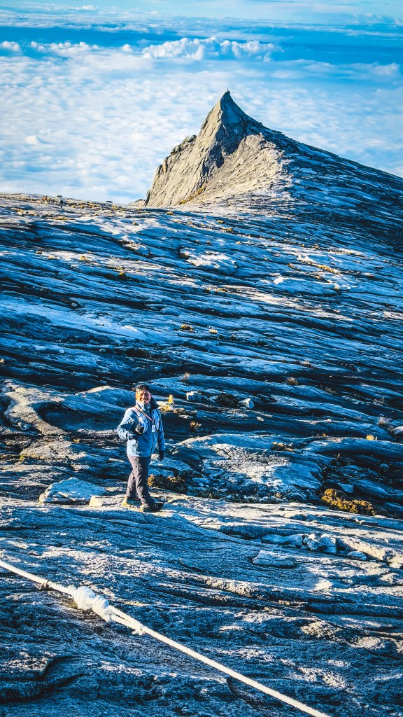

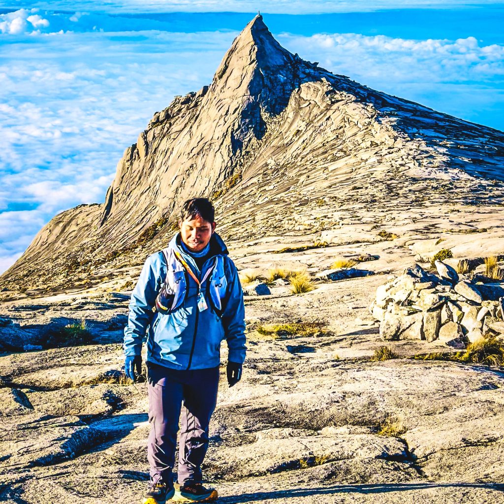
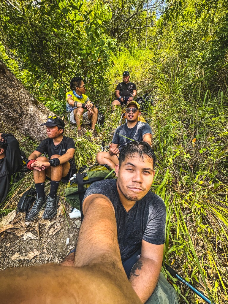
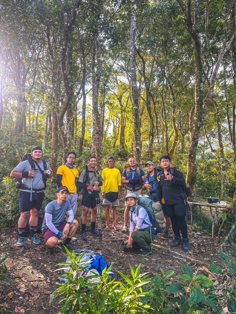
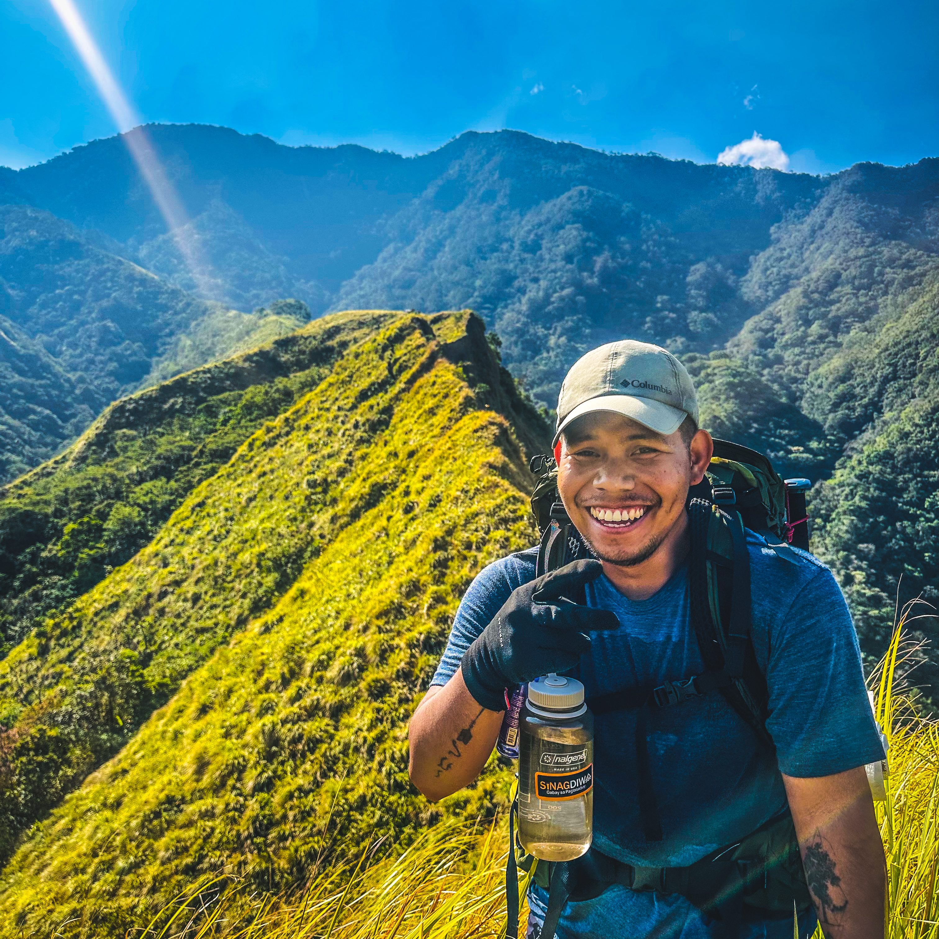
Less than two weeks after conquering Mt. Kinabalu, I and my partner, found ourselves preparing for another challenge—one of the toughest hiking adventures in the Philippines. Organized by our close friend Sinag Diwa, our group of eight set out for what we thought would be a “chill” 3-day, 2-night backtrail hike for each mountain.
Spoiler alert: it wasn’t chill.
Arrival and Preparation: From Iloilo to the Foot of Mt. Nangtud
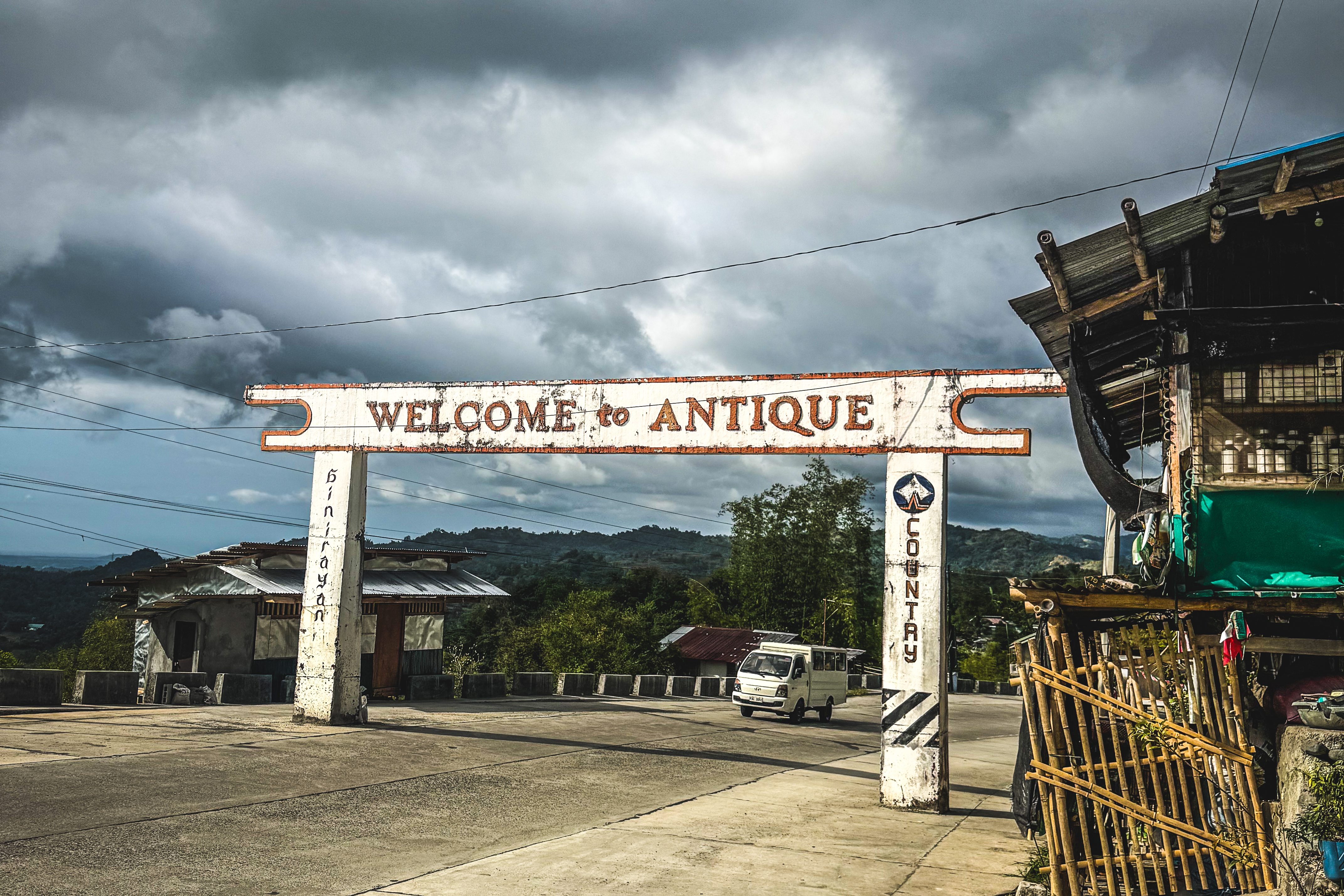
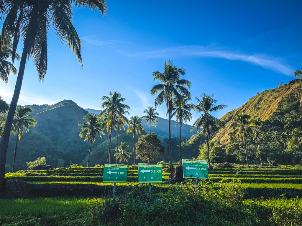
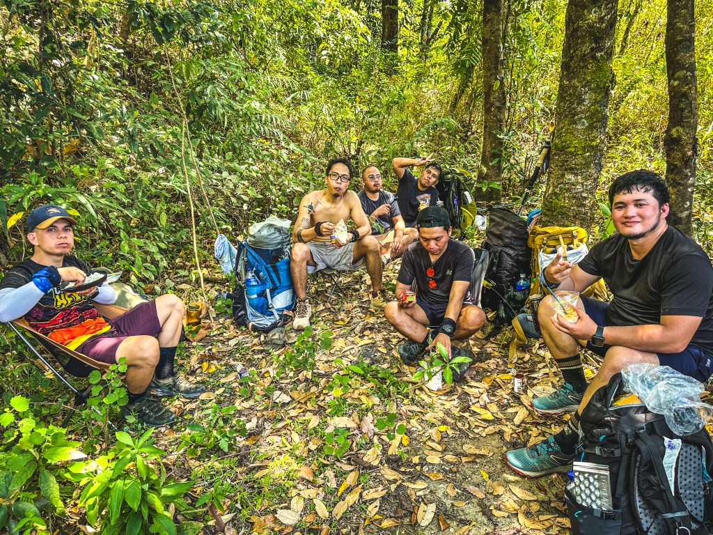
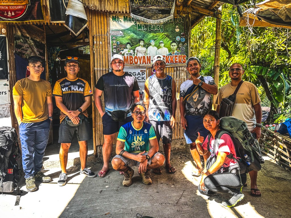
We flew via Cebu Pacific from Manila to Iloilo—almost missing our flight due to a boarding time mishap (a stressful start to an already intense trip). After regrouping, we met Sinag, who had everything planned for Day 1 at Mt. Nangtud in Barbaza, Antique.
A four-hour van ride brought us closer to the jump-off point. Before reaching our homestay, we stopped at the police station to register and secure permits, then grabbed last-minute supplies at the local market.
By nightfall, we arrived at the home of Tatay Nitoy—the legendary guide of Mt. Nangtud. After a hearty dinner and meaningful conversations with the group, we called it a night, resting early for the long day ahead.
The Time and Trail: Heat, Rivers, and Relentless Terrain
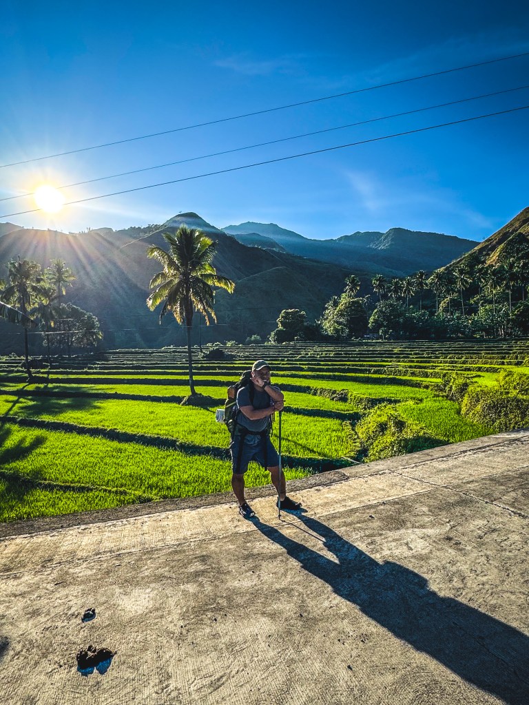
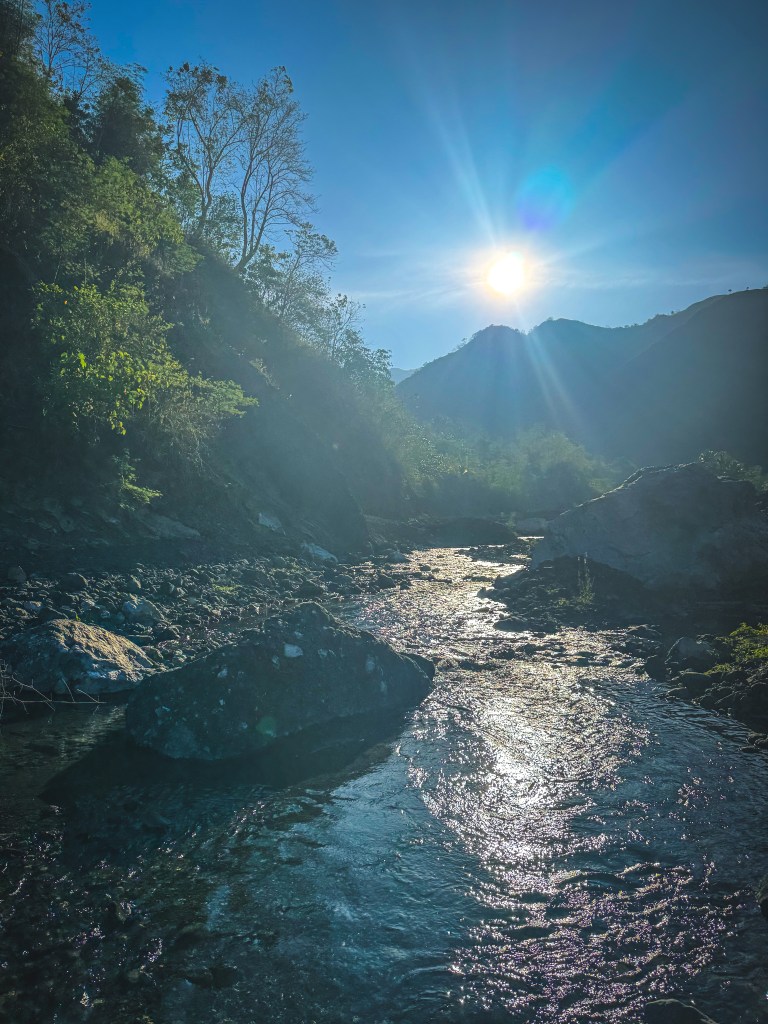
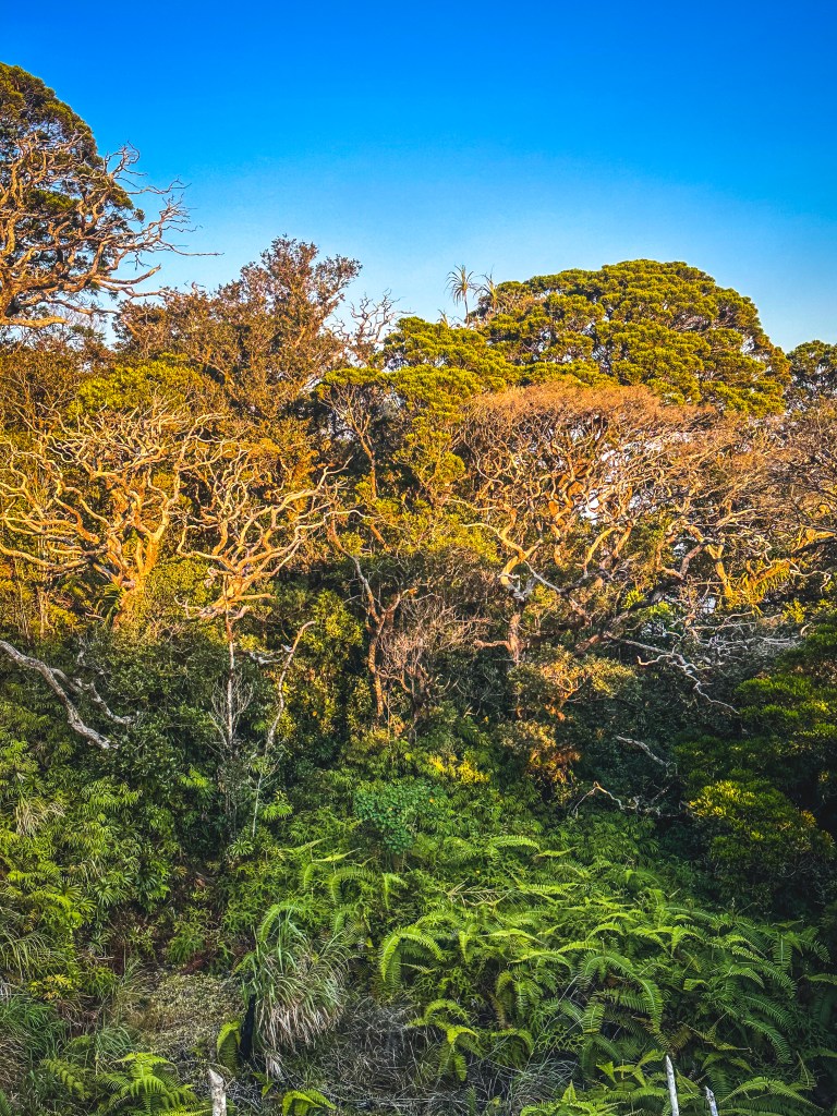
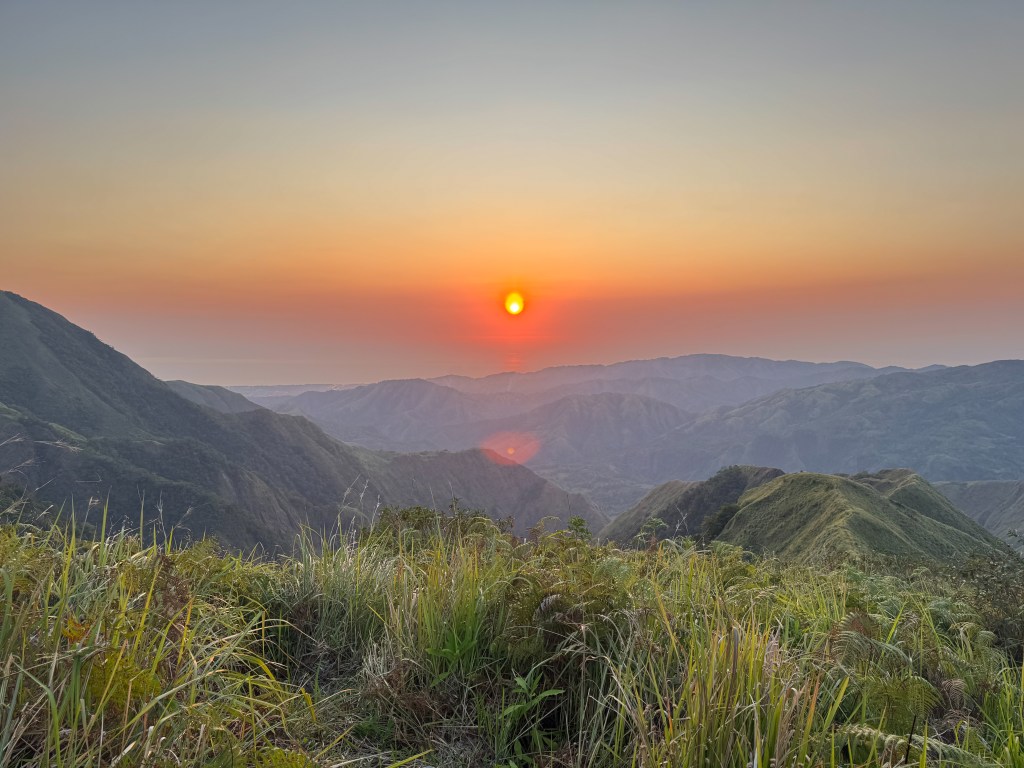
The morning greeted us with golden sunlight and clear skies—perfect for photos, but brutal for hiking.
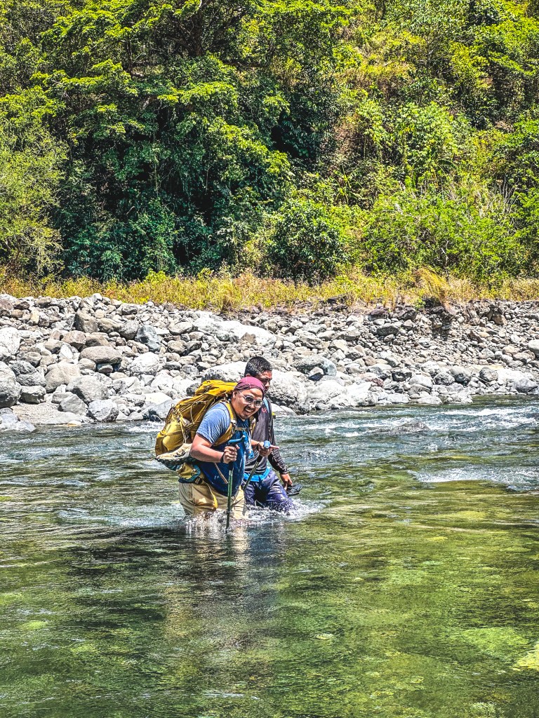
We started at 7 AM, carrying our essentials: tents, sleeping bags, food, water, and extra clothes. According to our guide, Day 1 would be 70% river trekking and 30% steep ascent.
Sounds manageable, right?
Not quite.
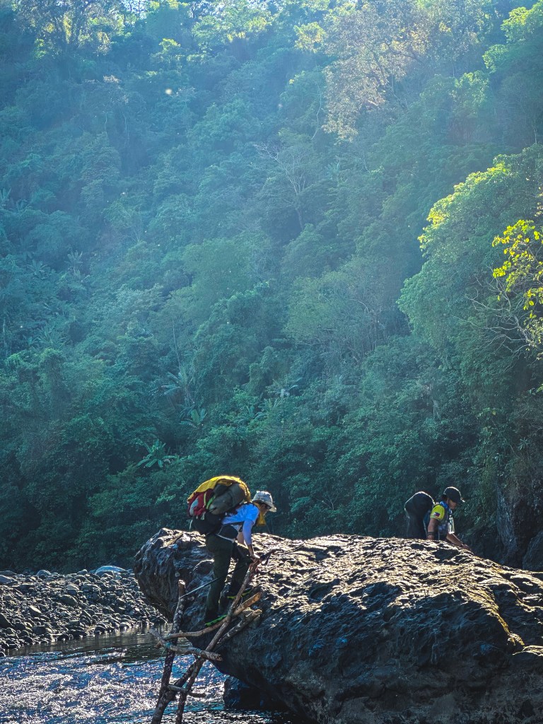
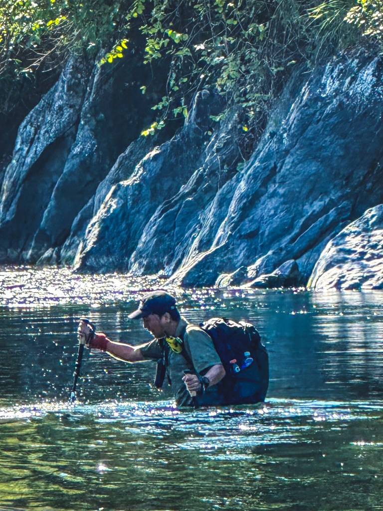
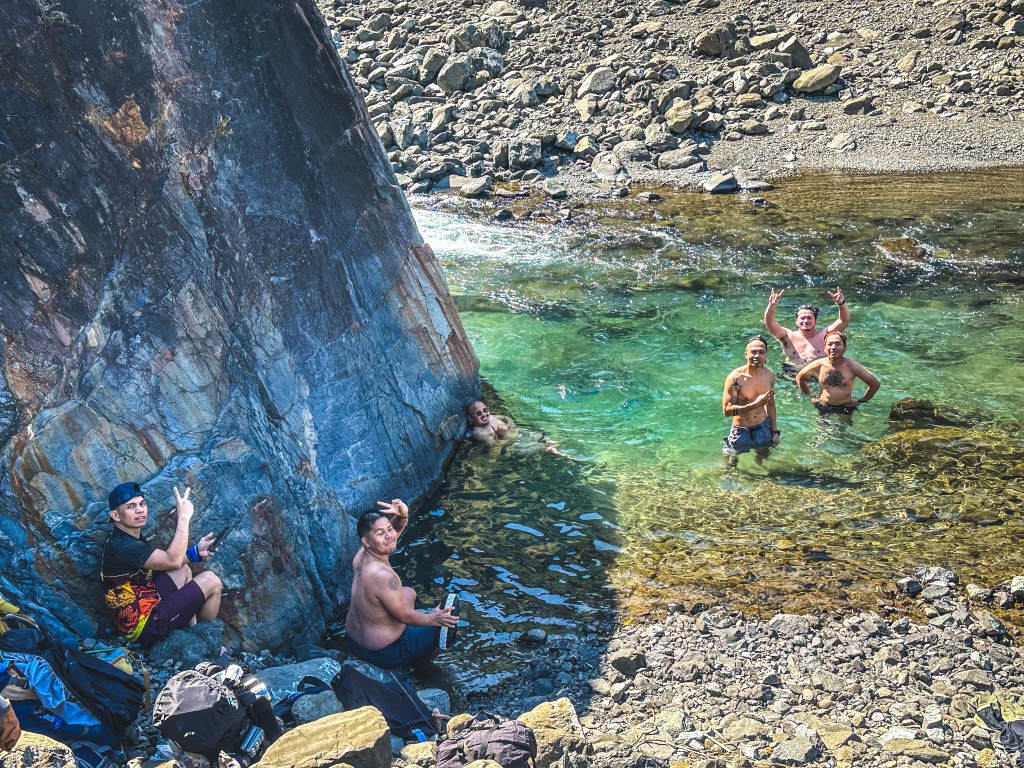
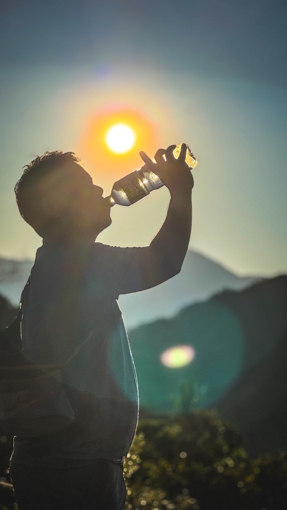
Within minutes, we encountered our first river crossing. Then another. And another. I eventually lost count. The summer heat was intense, but every river crossing offered temporary relief—a refreshing reset before pushing forward again.
Along the way, we passed local communities. Seeing locals carry sacks of rice and harvests reminded me of a life I once knew. It made me pause and reflect on how far I’ve come—and quietly hope that their lives, too, would one day become easier.
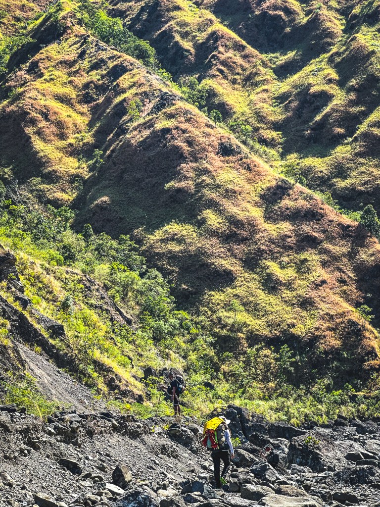
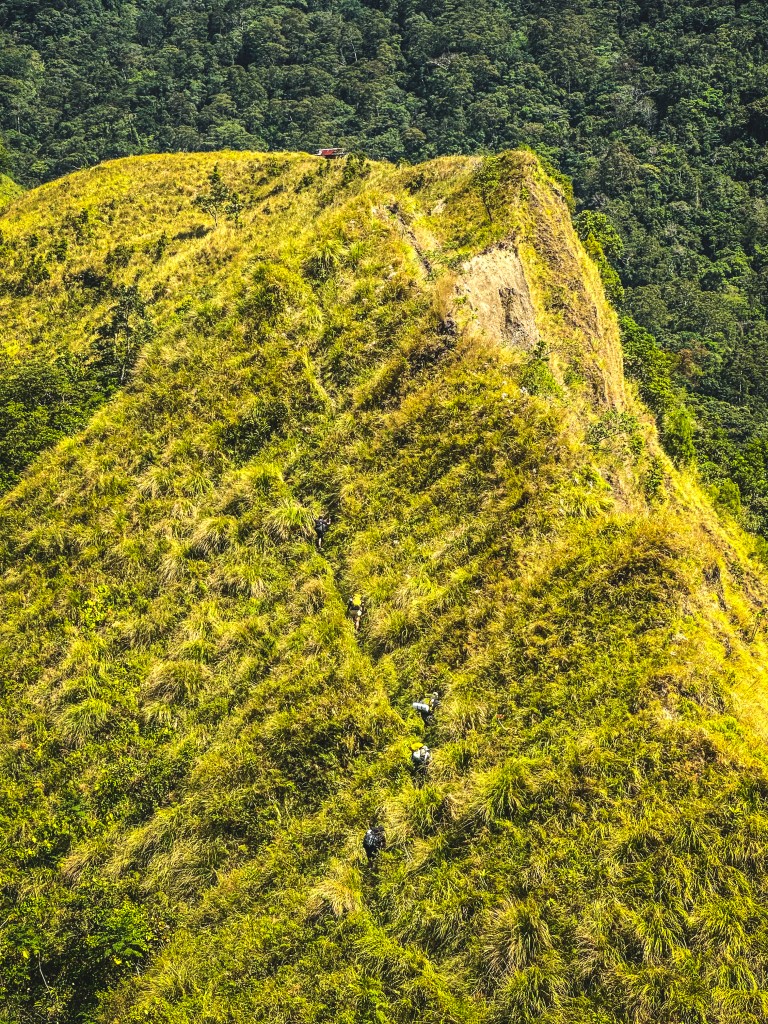
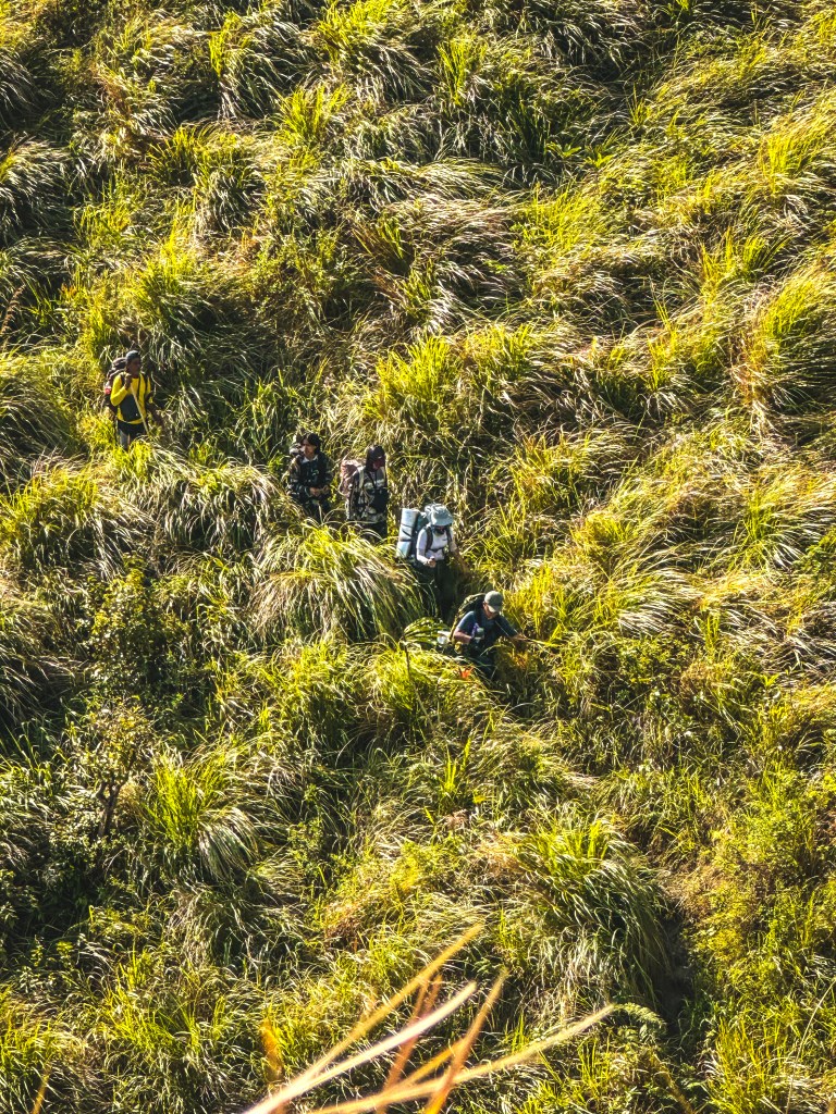
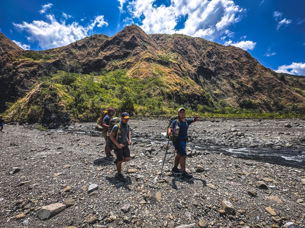
After hours of endless crossings, we reached the start of the ascent. Loose rocks. Crumbling soil. Zero shade. Every step demanded focus. One wrong move could mean serious danger.
This wasn’t just a hike anymore—it was survival.
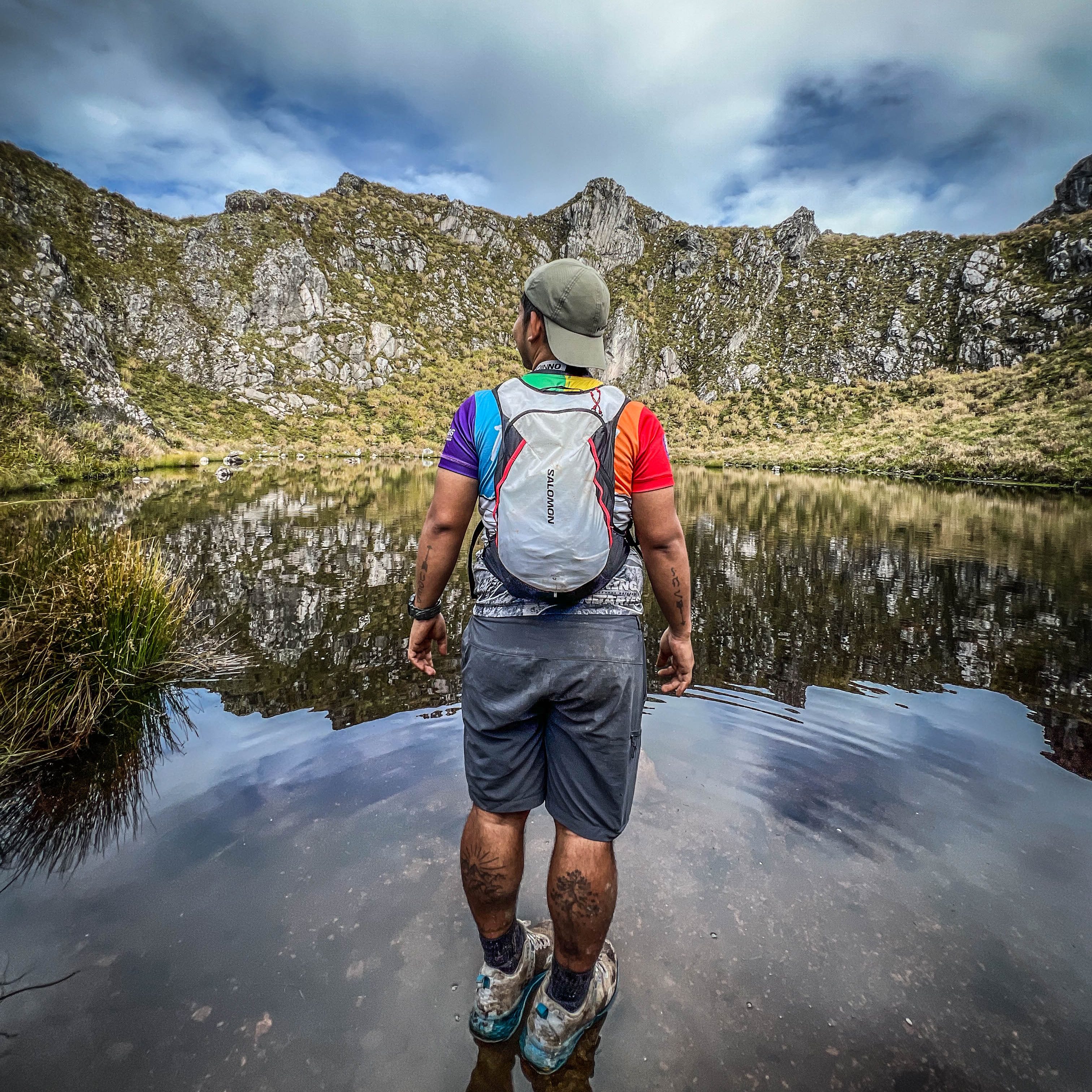
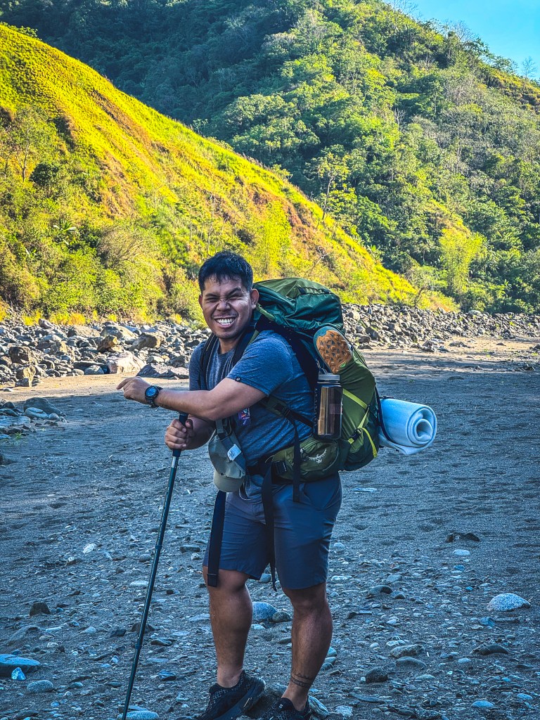
We took a brief break by a massive rock formation, where we cooled down with a quick swim. It was one of the few moments that truly felt “chill.”
But the mountain wasn’t done with us.
The Assault: Fear, Ridges, and Mental Battles
By late morning, we began the most difficult section—an exposed climb with loose terrain and steep slopes. The sun was unforgiving. The trail was unstable. And fear slowly crept in.
There were moments I wanted to give up.
But I didn’t.
We reached an emergency campsite just before noon and stopped for lunch under the shade of a few trees. It was a small but meaningful relief.
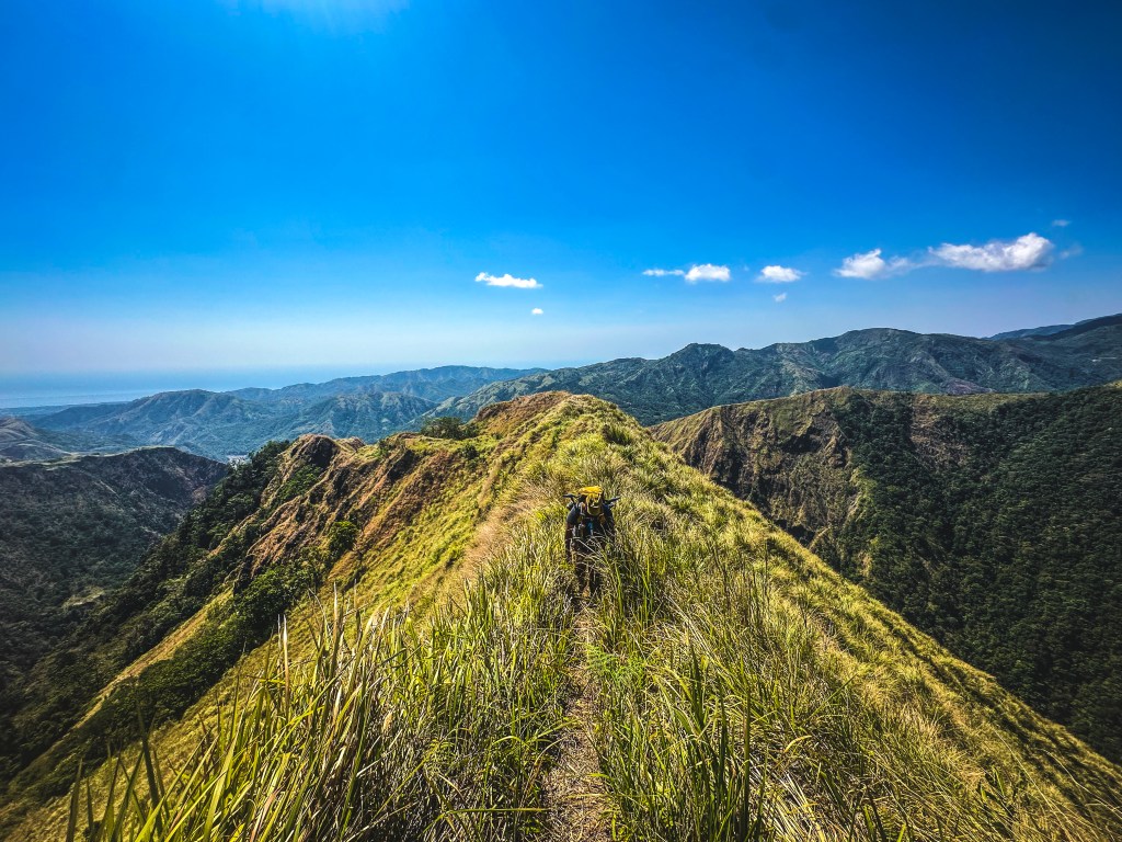
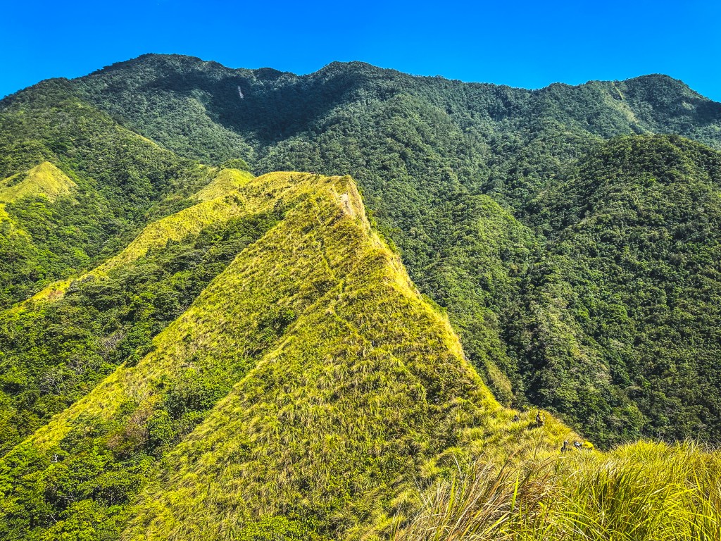
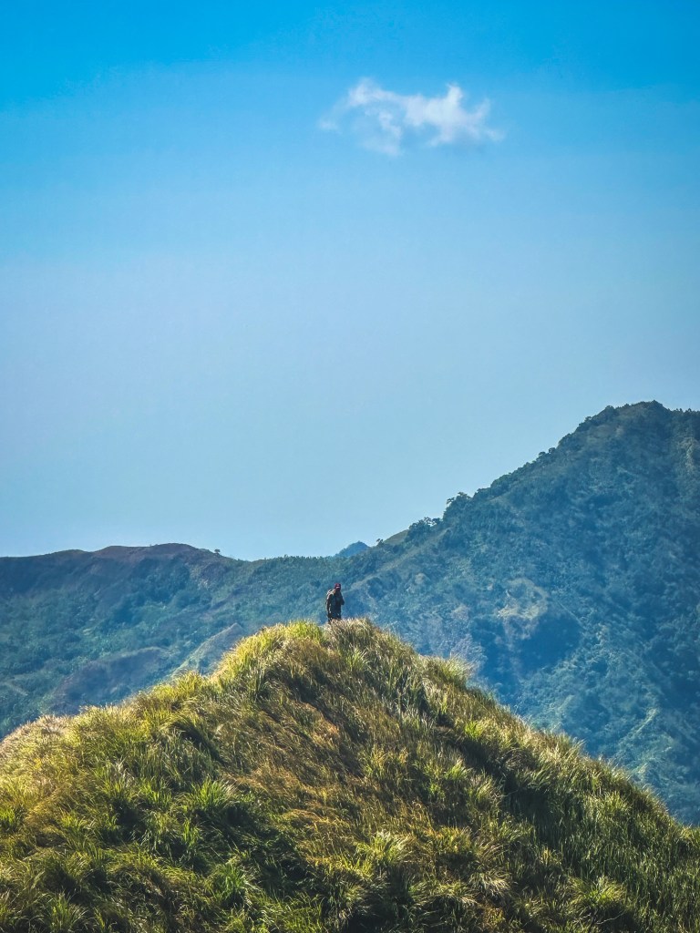
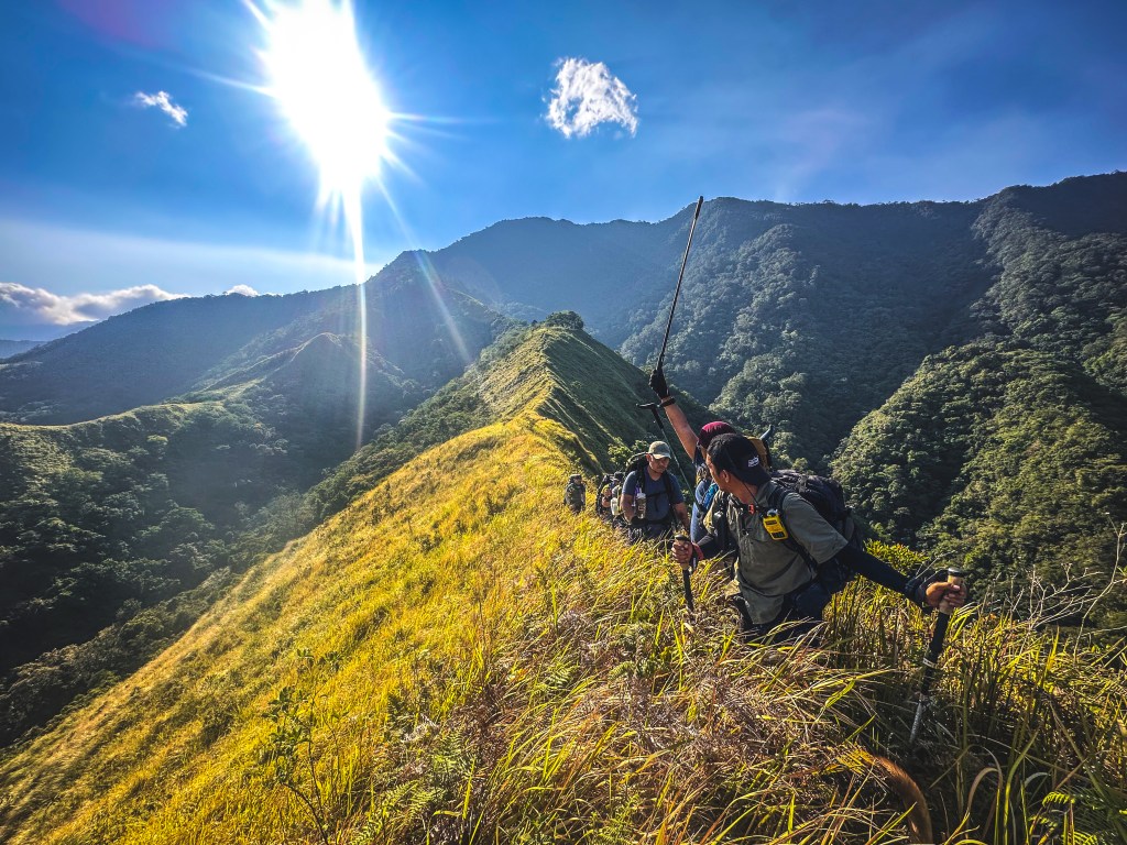
Then came the final assault to the ridge—steep, grassy, and terrifying. We held onto talahib grass just to stay balanced. One misstep could send you falling.
This was my breaking point.
Fear was loud. Doubt was louder.
But I kept moving.
Slowly. Carefully. Alone at times.
By almost 4 PM, after nine exhausting hours, I finally reached the campsite.
Summit Push: The Long Road to the Top
We planned to start at 2 AM, but exhaustion took over. We eventually left at 4:48 AM under a pitch-black sky, aiming for the summit of Mt. Nangtud.
We were told it would take two hours.
It didn’t.
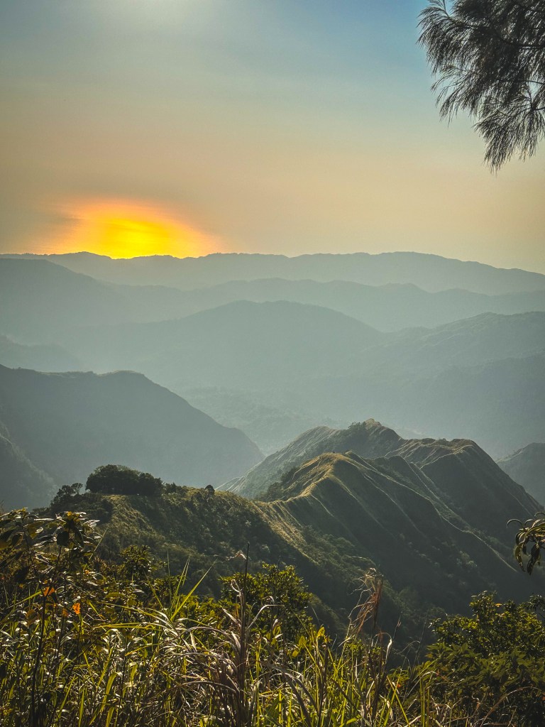
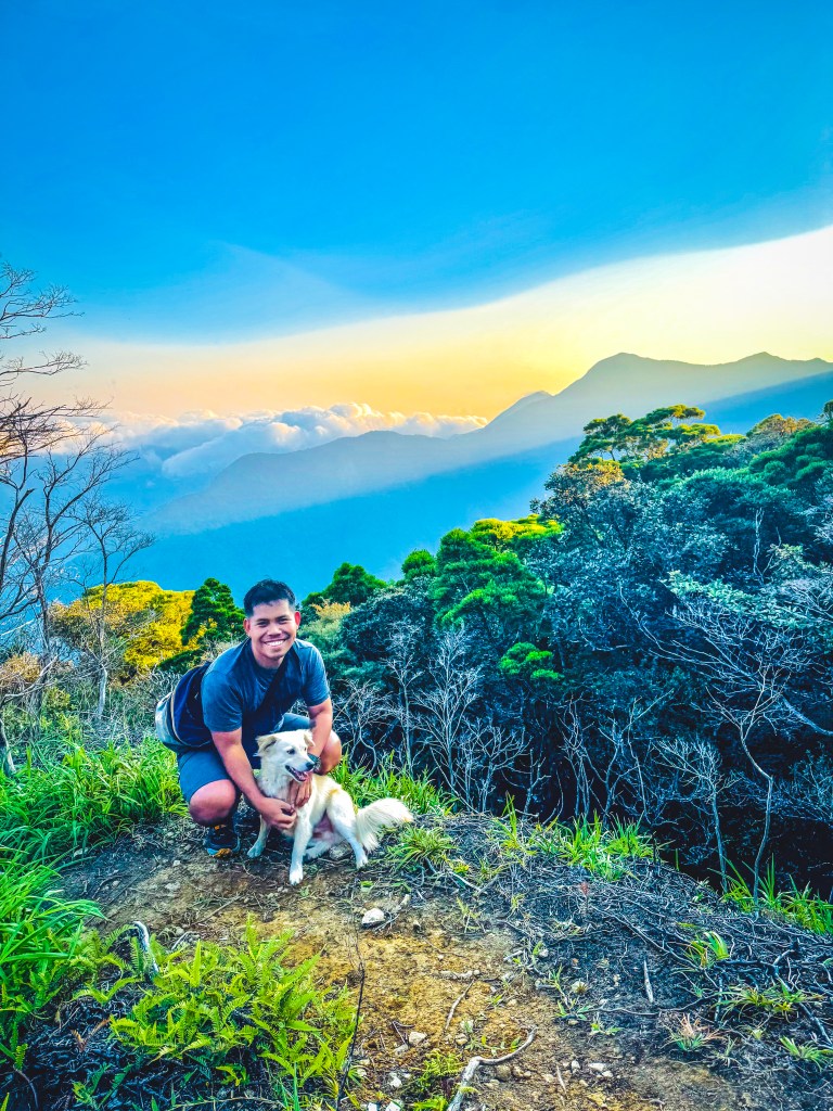
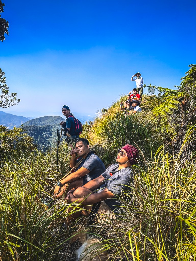
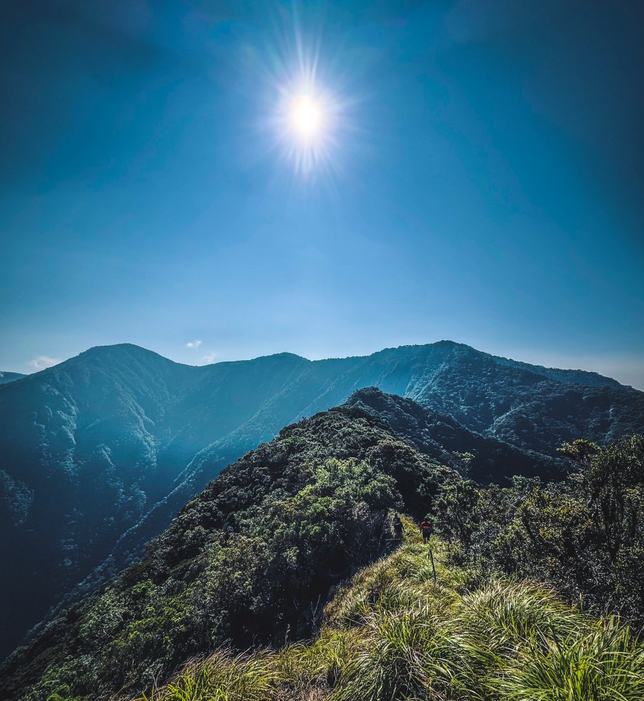
The trail was relentless—steep ascents, root climbs, ridges, and dense forest. Hours passed. The sunrise painted the forest in gold, giving us a brief moment of peace.
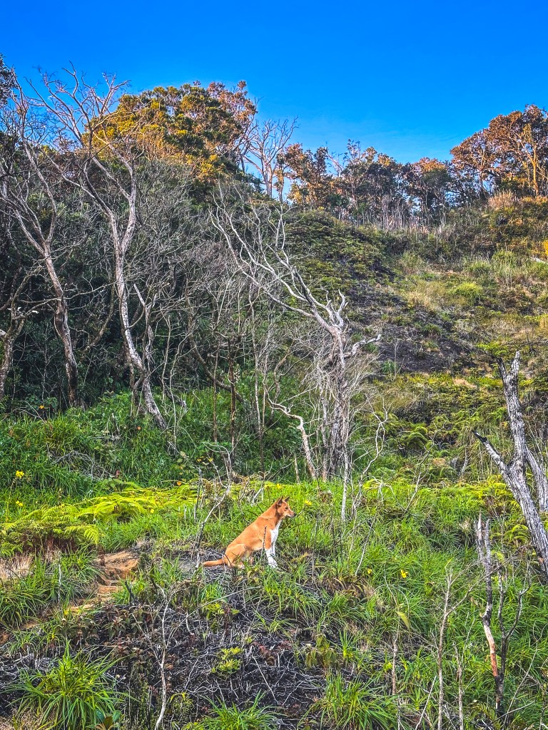
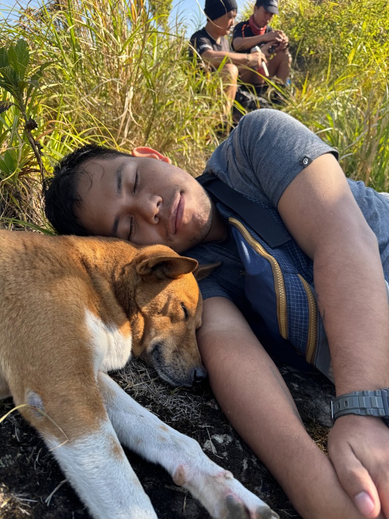
At one viewpoint, we caught a glimpse of Mt. Madjaas—beautiful and intimidating. Two guide dogs joined us, and I nicknamed them Browny and Whitey.
After reaching the last water source, our guide dropped the truth: four more hours to the summit.
That was the moment we accepted reality.
We climbed. And climbed. And climbed.
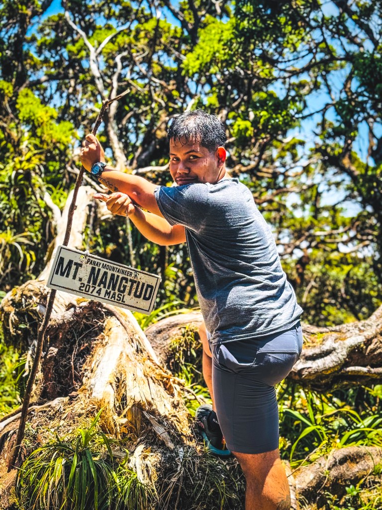
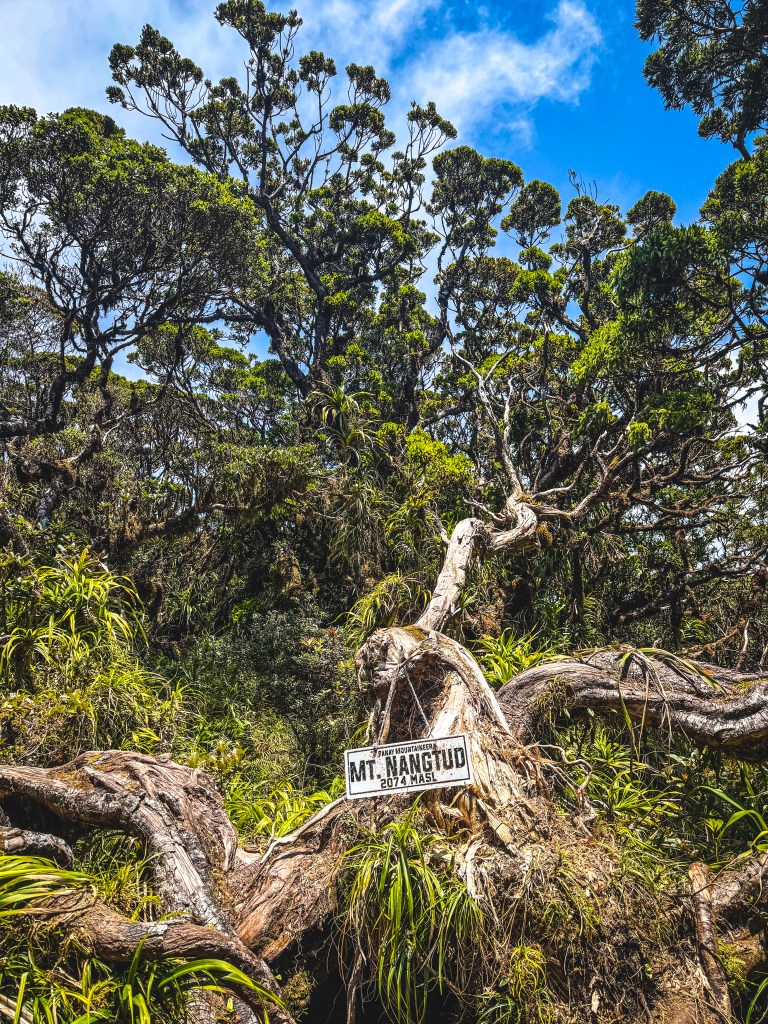
At 11:45 AM—after more than seven hours—we finally stood at the summit of Mt. Nangtud (2,074 MASL), the second-highest peak in Panay.
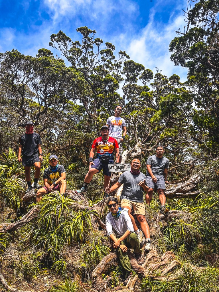
Exhausted. Relieved. Grateful.
The Descent: No Easy Way Down
The descent was no easier. Loose sand, intense heat, and tired legs made every step risky.
It took us four hours to return to camp.
On Day 3, we retraced our path back to the jump-off point—enduring the same ridges, river crossings, and unforgiving heat. At one point, I had to ask our guide to carry my bag.
Five hours later, we were back at Tatay Nitoy’s house.
Drained—but fulfilled.
The Toil: How Difficult Was It?
If I had to rate the difficulty?
10/9
Endless river crossings. Massive boulders. Exposed ridges. Loose soil. Steep ascents.
Mt. Nangtud will test your strength, your endurance, and most of all—your mindset.
But it will also reward you with raw, untouched beauty that makes every struggle worth it.
Final Thoughts: Why We Keep Climbing
This mountain is not for the faint-hearted.
But with the right preparation, discipline, and mindset—you can survive it.
Because in the mountains, you don’t just conquer peaks.
You discover who you are when things get hard.
And sometimes, that’s the real summit.

Frequently Asked Questions❓
1. How difficult is Mt. Nangtud in the Panay Trilogy?
Mt. Nangtud is considered one of the most difficult hikes in the Philippines, with a difficulty rating of around 9/9. Hikers face steep ascents, loose soil, exposed ridges, and multiple river crossings, making it physically and mentally demanding.
2. How many days do you need to hike Mt. Nangtud?
Most hikers complete Mt. Nangtud in 3 days and 2 nights, especially when done as a backtrail hike. This allows enough time for a safe ascent, summit push, and descent.
3. What is the best time to hike Mt. Nangtud?
The best time to hike Mt. Nangtud is during the dry season (February to May) to avoid slippery trails and dangerous river conditions. However, expect intense heat during summer months.
4. Do you need a guide to hike Mt. Nangtud?
Yes, hiring a local guide is highly recommended and required. The trail is complex, with multiple river crossings and unmarked paths, making navigation difficult without experienced guidance.
5. What should you prepare for the Panay Trilogy hike?
Proper preparation includes:
- Endurance training for long hiking hours
- Lightweight but complete camping gear
- Enough hydration and water filtration tools
- Emergency food and first aid kit
- Mental readiness for extreme trail conditions
6. How many river crossings are there in Mt. Nangtud?
There are dozens of river crossings, especially on Day 1 and 3, where hikers spend up to 80% of the time trekking along rivers. Expect wet shoes, slippery rocks, and constant cooling breaks.
7. Is Mt. Nangtud beginner-friendly?
No, Mt. Nangtud is not recommended for beginners. It is best suited for experienced hikers with strong endurance and prior exposure to technical trails.
8. What makes the Panay Trilogy special for hikers?
The Panay Trilogy is known for its raw, untouched beauty, featuring dense forests, scenic ridges, and challenging terrains. It offers a true wilderness experience compared to more commercialized hiking destinations in the Philippines.
9. How high is Mt. Nangtud?
Mt. Nangtud stands at approximately 2,074 meters above sea level (MASL), making it the second-highest mountain in Panay Island.
10. How much does it cost to hike Mt. Nangtud (Panay Trilogy)?
For this trip, we joined an organized hike and paid a total of ₱9,650 per person for the Mt. Nangtud–Mt. Madjaas event. This fee already included organized logistics, guide fees, permits, van transportation, and hosted meals.
However, some expenses were not included and were paid out of pocket, such as:
- Motorcycle (habal-habal) rides
- Guide and porter tips
- Personal extras (snacks, additional gear, etc.)
Overall, joining an organized hike is a convenient option, especially for a complex and challenging trail like Mt. Nangtud, as it takes care of most logistics and coordination.
I hope this adventure inspires and prepares you for your own #ChillAdventures. Remember—every summit reached is just one more step closer to your next great chill adventure.
For more hiking stories, travel tips, and hidden gems in the Philippines, follow Chill Adventures with Joms across all social media platforms.
Till the next blog, mga ka-Ahon—see you on the trails.

